Approximate Location Map
Large Map »
Latitude: 52.0614 / 52°3'41"N
Longitude: -1.3398 / 1°20'23"W
OS Eastings: 445359
OS Northings: 240543
OS Grid: SP453405
Mapcode National: GBR 7ST.Q30
Mapcode Global: VHCW7.QGK2
Plus Code: 9C4W3M66+H3
Entry Name: Gatepiers of St Marys Churchyard
Listing Date: 7 October 1969
Grade: II
Source: Historic England
Source ID: 1046943
English Heritage Legacy ID: 244368
ID on this website: 101046943
Location: Banbury, Cherwell, Oxfordshire, OX16
County: Oxfordshire
District: Cherwell
Civil Parish: Banbury
Built-Up Area: Banbury
Traditional County: Oxfordshire
Lieutenancy Area (Ceremonial County): Oxfordshire
Church of England Parish: Banbury St Mary
Church of England Diocese: Oxford
Tagged with: Gatepost
BANBURY HORSE FAIR
SP4540NW (East side)
6/74
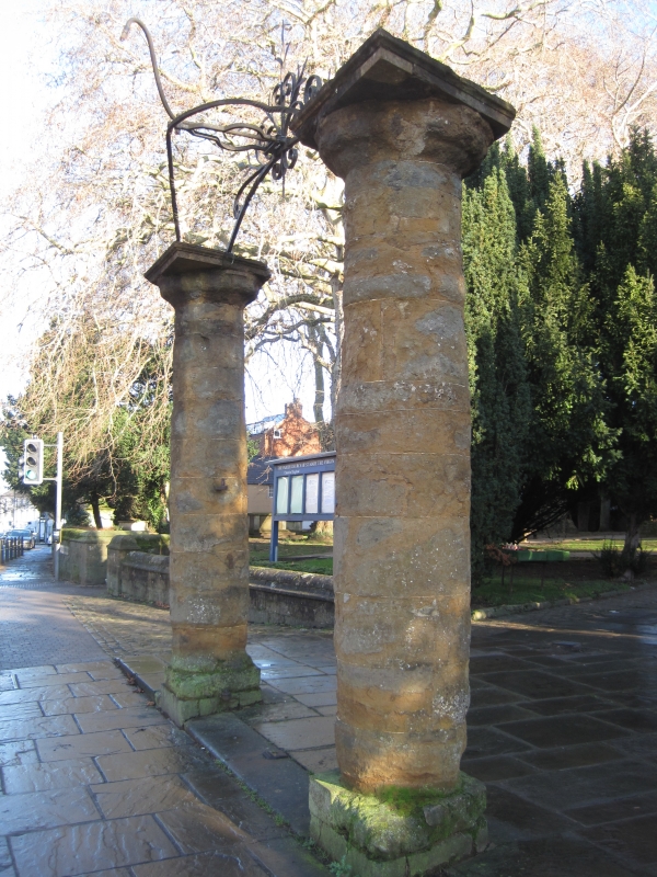
07/10/69 Gatepiers of St. Mary's
Churchyard
GV II
Two piers linked by overthrow. C18. Ironstone and wrought iron. Piers are
circular and badly weathered.
Listing NGR: SP4536040542
External links are from the relevant listing authority and, where applicable, Wikidata. Wikidata IDs may be related buildings as well as this specific building. If you want to add or update a link, you will need to do so by editing the Wikidata entry.


Other nearby listed buildings
