Latitude: 51.5376 / 51°32'15"N
Longitude: -0.9023 / 0°54'8"W
OS Eastings: 476228
OS Northings: 182644
OS Grid: SU762826
Mapcode National: GBR C4S.DQV
Mapcode Global: VHDWG.9MV5
Plus Code: 9C3XG3QX+23
Entry Name: The Elizabethan House
Listing Date: 25 January 1951
Last Amended: 28 October 1974
Grade: II
Source: Historic England
Source ID: 1046995
English Heritage Legacy ID: 246172
ID on this website: 101046995
Location: Henley-on-Thames, South Oxfordshire, RG9
County: Oxfordshire
District: South Oxfordshire
Civil Parish: Henley-on-Thames
Built-Up Area: Henley-on-Thames
Traditional County: Oxfordshire
Lieutenancy Area (Ceremonial County): Oxfordshire
Church of England Parish: Henley-on-Thames
Church of England Diocese: Oxford
Tagged with: House
1. HART STREET 5355 (South Side)
Nos 40 & 40A (The Elizabethan House) and No 42 (Formerly listed as No 40 Elizabethan House)
SU 7582 1/36 25.1.51.
II GV
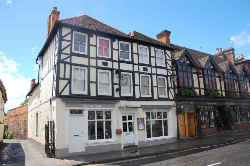
2. C16 and later, timber framed with plaster and painted brick infill. Double span, hipped, old tiled roof. 3 storeys, 5 windows, sashes with late C19 glazing. Ground floor has 2 early C19 shop windows under cornices. Eastern one incorporates door and has dentil cornice, entablature and pilasters. Western window simpler, with pilasters. Central door with architrave and small flathood. Side red brick and flint wall to east provides an important link with the Old School House at rear (q.v.)
Nos 2 to 8 (even) Nos 14 to 36 (even) including Adam House, and Nos 40 44, and gates and piers 48, 50, The Old School House and the Rectory Garden Wall form a group with Nos 5 to 39 (odd), the Drinking Fountain, the Parish Church of St Mary and the raised pavement at the east end of Hart Street.
Listing NGR: SU7623182640
External links are from the relevant listing authority and, where applicable, Wikidata. Wikidata IDs may be related buildings as well as this specific building. If you want to add or update a link, you will need to do so by editing the Wikidata entry.


Other nearby listed buildings