Latitude: 51.5416 / 51°32'29"N
Longitude: -0.9053 / 0°54'18"W
OS Eastings: 476017
OS Northings: 183089
OS Grid: SU760830
Mapcode National: GBR C4R.CY3
Mapcode Global: VHDWG.8J82
Plus Code: 9C3XG3RV+JV
Entry Name: 30, Northfield End
Listing Date: 28 October 1974
Grade: II
Source: Historic England
Source ID: 1047761
English Heritage Legacy ID: 246310
ID on this website: 101047761
Location: Henley-on-Thames, South Oxfordshire, RG9
County: Oxfordshire
District: South Oxfordshire
Civil Parish: Henley-on-Thames
Built-Up Area: Henley-on-Thames
Traditional County: Oxfordshire
Lieutenancy Area (Ceremonial County): Oxfordshire
Church of England Parish: Henley-on-Thames
Church of England Diocese: Oxford
Tagged with: Building
1. NORTHFIELD END 5355 (East Side)
No 30 SU 7683 8/105
II GV
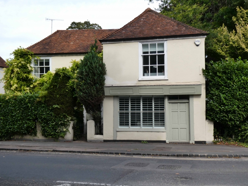
2. C18. Rendered brick facade, brick dentil cornice now partly concealed. Old tiled roof. 2 storeys, 2 windows including ground floor bay with moulded cornice, all sashes with glazing bars. C19 shop window with glazing bars but modern door. Additional, 6 panelled door with shouldered architrave and label above.
Denmark House, Elm House, Ruperts Elm, Ruperts Guard, White House, the Obelisk and No 30 form a group with Nos 1 to 11 and 15 to 25 (odd) opposite and with Nos 93 and 95, Nos 70 to 102 (even) and the building at the rear of No 70, Bell Street and also with Tarry's Cottage, Bell Cottage and The flat on Ruperts Lane.
Listing NGR: SU7601783089
External links are from the relevant listing authority and, where applicable, Wikidata. Wikidata IDs may be related buildings as well as this specific building. If you want to add or update a link, you will need to do so by editing the Wikidata entry.


Other nearby listed buildings