Latitude: 51.7744 / 51°46'27"N
Longitude: -1.3119 / 1°18'42"W
OS Eastings: 447572
OS Northings: 208634
OS Grid: SP475086
Mapcode National: GBR 7XB.R40
Mapcode Global: VHCXM.6NTM
Plus Code: 9C3WQMFQ+P6
Entry Name: The White Hart Inn and Attached Wall and Stable
Listing Date: 9 February 1966
Last Amended: 24 June 1987
Grade: II
Source: Historic England
Source ID: 1048279
English Heritage Legacy ID: 249852
ID on this website: 101048279
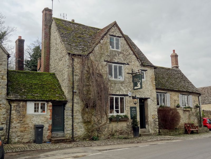
WYTHAM SP4708 10/175 The White Hart Inn and 09/02/66 attached wall and stable (Formerly listed as White Hart Inn) GV II Farmhouse, now public house. Late C17: extended mid/late C18. Uncoursed limestone rubble; cross-gabled stone slate roof; brick left end stack and rear lateral stack. 2 storeys and attic; one-window range. Timber lintels over C20 door to right, and 2- and 3-light casements. Mid C18 one-storey extension to right of similar materials with brick end stack and two 3-light leaded casements. Mid C18 rear wing of similar materials. Small one-storey, one-bay C18 extension to left of front, with C19 three-light casement. Interior: chamfered beams. Late C18 fireplace in rear room. First floor not inspected. Subsidiary features: limestone rubble wall approx. 20m. long attached to late C18 stable to right: of similar limestone rubble with gabled stone slate roof.
Listing NGR: SP4757808635
External links are from the relevant listing authority and, where applicable, Wikidata. Wikidata IDs may be related buildings as well as this specific building. If you want to add or update a link, you will need to do so by editing the Wikidata entry.


Other nearby listed buildings