Latitude: 51.5978 / 51°35'52"N
Longitude: -1.1249 / 1°7'29"W
OS Eastings: 460710
OS Northings: 189135
OS Grid: SU607891
Mapcode National: GBR 911.Y3W
Mapcode Global: VHCYP.G35G
Plus Code: 9C3WHVXG+42
Entry Name: 28 and 29, St Mary's Street
Listing Date: 17 March 1970
Grade: II
Source: Historic England
Source ID: 1048474
English Heritage Legacy ID: 249314
ID on this website: 101048474
Location: Wallingford, South Oxfordshire, OX10
County: Oxfordshire
District: South Oxfordshire
Civil Parish: Wallingford
Built-Up Area: Wallingford
Traditional County: Berkshire
Lieutenancy Area (Ceremonial County): Oxfordshire
Tagged with: Building
WALLINGFORD ST. MARY'S STREET
SU6089SE (East side)
Wallingford
11/148 Nos.28 and 29
17/03/70
GV II
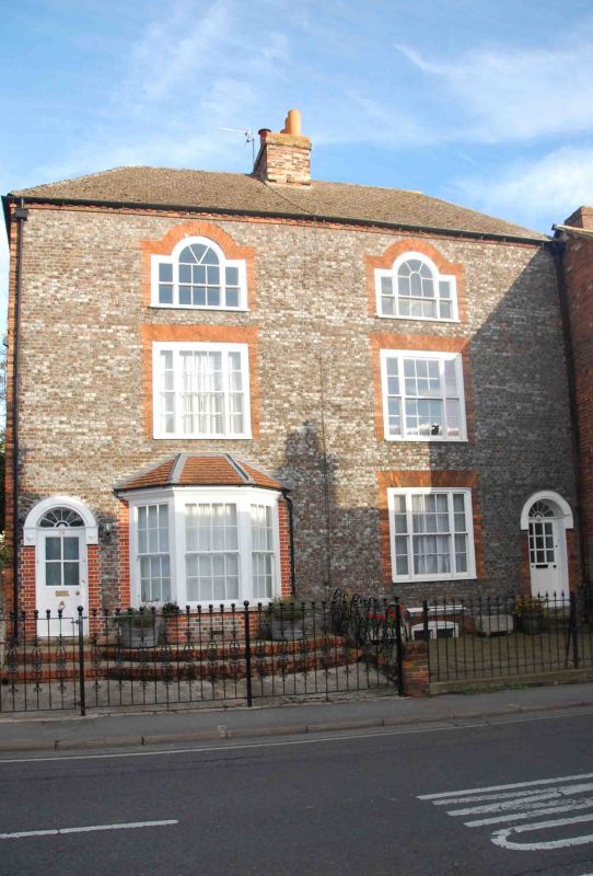
Two houses. Late C18, with C20 alterations. Grey brick with red brick dressings;
late C20 plain-tile hipped roof; brick ridge stack to centre. 3-storey, 2-window
range. Sash doors with decorative fanlights to left and right. C20 bow window
with flat roof to left of centre. Tripartite unhorned sash with glazing bars and
cambered rubbed brick head to right of centre. 2 tripartite unhorned sashes with
glazing bars and cambered rubbed brick heads to first floor. 2 Venetian windows
with unhorned sashes with glazing bars and cambered rubbed brick heads to second
floor. Dentil course to eaves. Left return of knapped flint with red brick
dressings, banded to second floor. Interiors not inspected.
Listing NGR: SU6071089135
External links are from the relevant listing authority and, where applicable, Wikidata. Wikidata IDs may be related buildings as well as this specific building. If you want to add or update a link, you will need to do so by editing the Wikidata entry.


Other nearby listed buildings