Latitude: 51.6434 / 51°38'36"N
Longitude: -1.5076 / 1°30'27"W
OS Eastings: 434171
OS Northings: 193955
OS Grid: SU341939
Mapcode National: GBR 6X9.X9V
Mapcode Global: VHC0M.TYCL
Plus Code: 9C3WJFVR+8X
Entry Name: Campdene House
Listing Date: 15 January 1986
Grade: II
Source: Historic England
Source ID: 1048581
English Heritage Legacy ID: 251084
ID on this website: 101048581
Location: Stanford in the Vale, Vale of White Horse, Oxfordshire, SN7
County: Oxfordshire
District: Vale of White Horse
Civil Parish: Stanford in the Vale
Built-Up Area: Stanford in the Vale
Traditional County: Berkshire
Lieutenancy Area (Ceremonial County): Oxfordshire
Church of England Parish: Stanford-in-the-Vale with Goosey and Hatford
Church of England Diocese: Oxford
Tagged with: House
STANFORD-IN-THE-VALE UPPER GREEN SU3493 (North side) 9/254 No.8 (Campdene House)
GV II
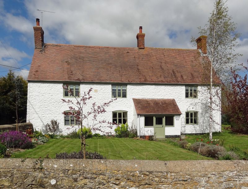
Farmhouse. Datestone VD/1702. Coursed limestone rubble brought to course, brick quoins to right; mid C20 tile roof; brick stacks. 3-unit plan. 2 storeys; window range. Mid C20 porch and entry not in original position. Brick jambs and segmental arches to early C20 three-light casements. Gabled roof; left gable end and ridge stacks, late C19 gable end stack to right. Rear wall obscured by late C19 gabled brewhouse (now garage), late C19 lean-to and late C20 wing. Interior not inspected but likely to be of interest. The datestone to the top left of the front wall probably commemorates a marriage as the initials VD are separated from the initials below by an inscribed heart. This used to be the "Crown Prince Inn", changed to "The Prince" due to the unpopularity of the German Crown Price in the 1914-18 war. Old photographs show that since the early C20 the eaves height to the right of the central chimney has been built up and the door shifted to the left to its present position opposite the stack. (V.H. Howse, Stanford-in-the-Vale; A Parish Record, 1962, Vol.I, p.27).
Listing NGR: SU3417193955
External links are from the relevant listing authority and, where applicable, Wikidata. Wikidata IDs may be related buildings as well as this specific building. If you want to add or update a link, you will need to do so by editing the Wikidata entry.


Other nearby listed buildings