Approximate Location Map
Large Map »
Latitude: 52.9319 / 52°55'54"N
Longitude: 1.3007 / 1°18'2"E
OS Eastings: 621926
OS Northings: 342264
OS Grid: TG219422
Mapcode National: GBR VBR.5NS
Mapcode Global: WHMS2.YKJQ
Plus Code: 9F43W8J2+Q7
Entry Name: 9, High Street
Listing Date: 21 January 1977
Grade: II
Source: Historic England
Source ID: 1049013
English Heritage Legacy ID: 222523
ID on this website: 101049013
Location: Cromer, North Norfolk, NR27
County: Norfolk
District: North Norfolk
Civil Parish: Cromer
Built-Up Area: Cromer
Traditional County: Norfolk
Lieutenancy Area (Ceremonial County): Norfolk
Church of England Parish: Cromer St Peter and St Paul
Church of England Diocese: Norwich
Tagged with: Building
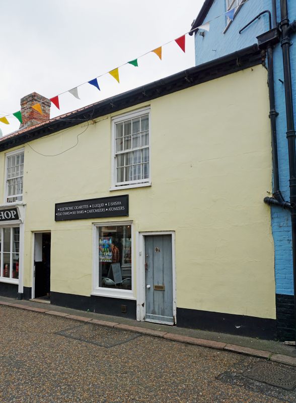
HIGH STREET
1.
5320
(East Side)
No 9
TG 2142 1/30
II GV
2.
Early C19. Stuccoed. Pantile roof. Brick dentil eaves. 2 storeys. 1st floor
2 sashes with glazing bars. Ground floor sash replaced by plate glass, later C19
shop with fluted pilasters, fascia with cornice, and 10 large panes. 2 doors,
one glazed and panelled, the other a plank door.
All listed buildings in High Street form a group together with all listed buildings
in Jetty Street, Jetty Cliff and West Cliff.
Listing NGR: TG2192642264
External links are from the relevant listing authority and, where applicable, Wikidata. Wikidata IDs may be related buildings as well as this specific building. If you want to add or update a link, you will need to do so by editing the Wikidata entry.


Other nearby listed buildings
