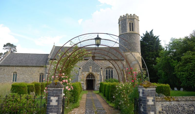
Latitude: 52.3813 / 52°22'52"N
Longitude: 1.0784 / 1°4'42"E
OS Eastings: 609610
OS Northings: 280378
OS Grid: TM096803
Mapcode National: GBR THQ.PGT
Mapcode Global: VHL96.MDZV
Plus Code: 9F4393JH+G9
Entry Name: Church of St Remigius
Listing Date: 7 December 1959
Grade: I
Source: Historic England
Source ID: 1050237
English Heritage Legacy ID: 225664
Also known as: St Remigius, Roydon, Norfolk
ID on this website: 101050237
Location: St Remigius's Church, Roydon, South Norfolk, IP22
County: Norfolk
District: South Norfolk
Civil Parish: Roydon
Built-Up Area: Diss
Traditional County: Norfolk
Lieutenancy Area (Ceremonial County): Norfolk
Church of England Parish: Roydon
Church of England Diocese: Norwich
Tagged with: Church building
1. 5321 ROYDON DISS ROAD Church of St Renigius TM 08 SE 18/1A 7.12.59
I
2. From C12. Norman nave, and round tower with Victorian octagonal top stage with battlements and Perpendicular bell openings. C13/14 chancel. C13 south aisle rebuilt in 1864. South porch by Vulliamy 1840 re-erected at east end of aisle. Large C15 north porch with flushwork panelling and niches and Perpendicular side windows. Interior: C13, 4-bay arcade with square piers and pointed arches with slight chamfer. C19 roofs. Of pulpit. Font? Materials: flint with ashlar dressings and black glazed pantile roofs.
Listing NGR: TM0961080378
External links are from the relevant listing authority and, where applicable, Wikidata. Wikidata IDs may be related buildings as well as this specific building. If you want to add or update a link, you will need to do so by editing the Wikidata entry.


Other nearby listed buildings