Latitude: 52.6322 / 52°37'56"N
Longitude: 1.1831 / 1°10'59"E
OS Eastings: 615503
OS Northings: 308587
OS Grid: TG155085
Mapcode National: GBR VG2.ZX4
Mapcode Global: WHLSG.43ND
Plus Code: 9F43J5JM+V6
Entry Name: Flint Cottage
Listing Date: 4 May 1973
Grade: II
Source: Historic England
Source ID: 1050781
English Heritage Legacy ID: 226407
ID on this website: 101050781
Location: Bawburgh, South Norfolk, NR9
County: Norfolk
District: South Norfolk
Civil Parish: Bawburgh
Traditional County: Norfolk
Lieutenancy Area (Ceremonial County): Norfolk
Church of England Parish: Bawburgh St Mary and St Walstan
Church of England Diocese: Norwich
Tagged with: Cottage
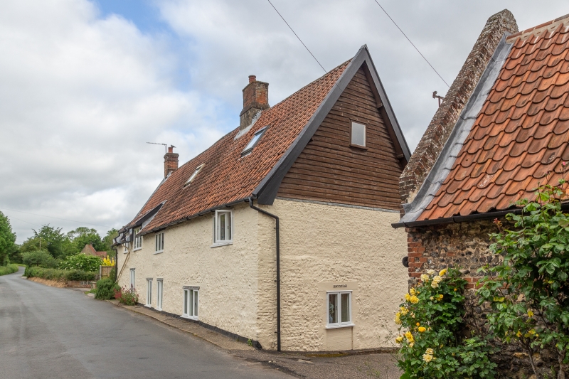
BAWBURGH CHURCH STREET TG 1508 (north side) 9/4 Flint Cottage 4.5.73 G.V. II C17, heavily restored. Colourwashed brick and flint with French pantiled roof. Lobby Entrance house with off-centre axial stack and later gable-end stack. Late C20 fenestration. Boarded east gable, partially rebuilt west gable-end and steep-pitched roof. C19 extension to rear. E. Mercer, English Vernacular Houses, 1975, p,188.
Listing NGR: TG1550308587
External links are from the relevant listing authority and, where applicable, Wikidata. Wikidata IDs may be related buildings as well as this specific building. If you want to add or update a link, you will need to do so by editing the Wikidata entry.


Other nearby listed buildings