Latitude: 54.5074 / 54°30'26"N
Longitude: -1.3554 / 1°21'19"W
OS Eastings: 441833
OS Northings: 512649
OS Grid: NZ418126
Mapcode National: GBR LJZ9.BZ
Mapcode Global: WHD74.4YTX
Plus Code: 9C6WGJ4V+XR
Entry Name: 17, Bentley Wynd
Listing Date: 21 June 1985
Grade: II
Source: Historic England
Source ID: 1051667
English Heritage Legacy ID: 59547
ID on this website: 101051667
Location: Yarm, Stockton-on-Tees, North Yorkshire, TS15
County: Stockton-on-Tees
Civil Parish: Yarm
Built-Up Area: Yarm
Traditional County: Yorkshire
Lieutenancy Area (Ceremonial County): North Yorkshire
Church of England Parish: Yarm St Mary Magdalene
Church of England Diocese: York
Tagged with: Building
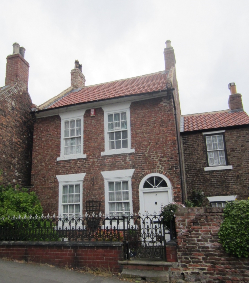
NZ 4112 NE YARM BENTLEY WYND
(North side)
37/569
No 17
GV II
Early-mid C19 L-shaped house. Pale red brick. Pantiled roof with end chimneys,
brick copings and kneelers. Wood dentilled eaves cornice. Sash windows with
glazing bars in wood architraves. Stuccoed lintels and stone cills. Architrave
to door with radial fanlight. Rear wing slightly lower and similar.
Listing NGR: NZ4183312649
External links are from the relevant listing authority and, where applicable, Wikidata. Wikidata IDs may be related buildings as well as this specific building. If you want to add or update a link, you will need to do so by editing the Wikidata entry.


Other nearby listed buildings