Latitude: 54.9916 / 54°59'29"N
Longitude: -2.588 / 2°35'16"W
OS Eastings: 362475
OS Northings: 566489
OS Grid: NY624664
Mapcode National: GBR BBCQ.HG
Mapcode Global: WH90T.6SWR
Plus Code: 9C6VXCR6+JR
Entry Name: Willowford and Adjoining Farm Buildings
Listing Date: 28 March 1984
Grade: II
Source: Historic England
Source ID: 1052362
English Heritage Legacy ID: 78078
ID on this website: 101052362
Location: Gilsland, Cumberland, Cumbria, CA8
County: Cumberland
District: Carlisle
Civil Parish: Upper Denton
Traditional County: Cumberland
Lieutenancy Area (Ceremonial County): Cumbria
Church of England Parish: Gilsland St Mary Magdalene
Church of England Diocese: Carlisle
Tagged with: Building
NY 66 NW UPPER DENTON GILSLAND
1/87 Willowford and adjoining farm buildings
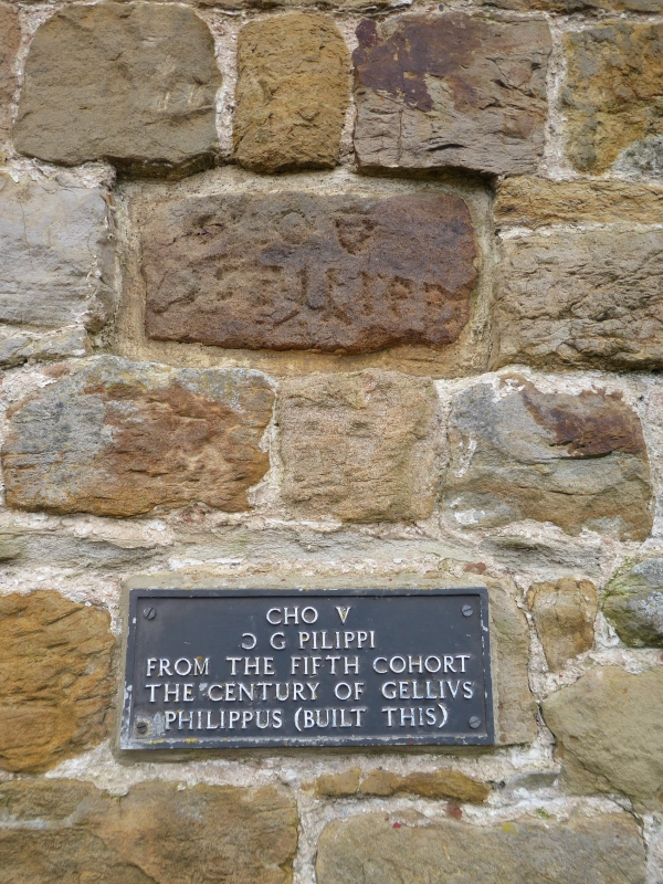
II Farmhouse and adjoining farm buildings. Dated 1830 over entrance. Squared and coursed calciferous sandstone rubble, partly of stone from the nearby Roman Wall, with raised quoins; slate roof with coped gables and kneelers, ashlar and C20 brick end chimney stacks. Farmhouse, 2 storeys, 3 bays. C20 door has alternate block surround, keyed and dated entablature. Replacement casements with glazing bars to ground floor and original sashes above, all with raised stone surrounds. Adjoining farmyard buildings enclose yard behind on 3 sides. One and 2 storeys, built of stone from the Roman Wall (which has been partly removed to allow access to farmyard); Welsh slate roofs, plank doors and slit vents. Listing does not include C20 breeze block garage extensions in farmyard. All buildings are built between the Roman Wall and vallum.
Listing NGR: NY6247566489
External links are from the relevant listing authority and, where applicable, Wikidata. Wikidata IDs may be related buildings as well as this specific building. If you want to add or update a link, you will need to do so by editing the Wikidata entry.


Other nearby listed buildings