Latitude: 51.6219 / 51°37'18"N
Longitude: -1.3197 / 1°19'11"W
OS Eastings: 447189
OS Northings: 191668
OS Grid: SU471916
Mapcode National: GBR 7Z8.94S
Mapcode Global: VHCYD.2HNJ
Plus Code: 9C3WJMCJ+P4
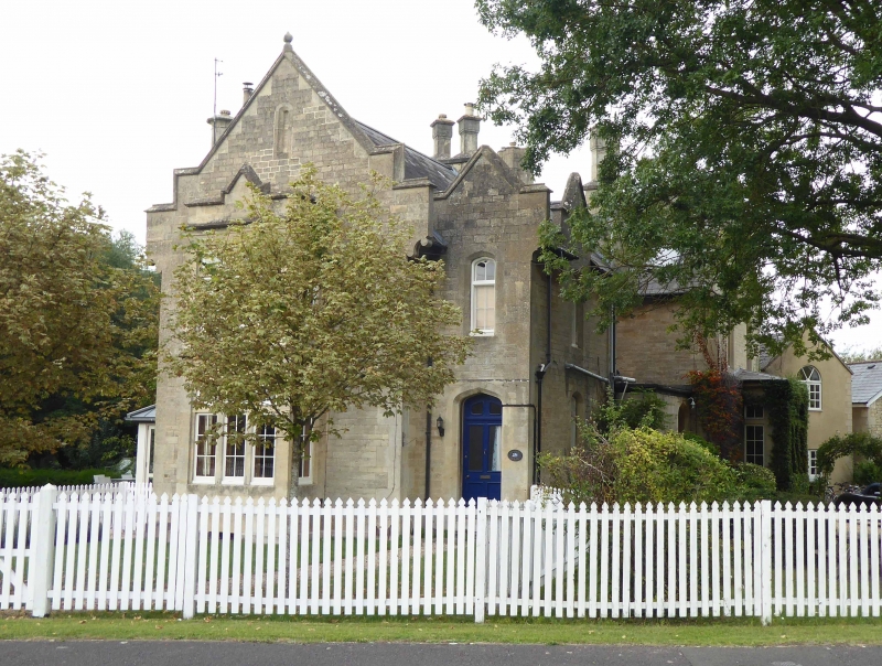
Entry Name: Station House and the Sycamores
Listing Date: 31 October 1983
Grade: II
Source: Historic England
Source ID: 1052750
English Heritage Legacy ID: 251363
ID on this website: 101052750
Location: Steventon, Vale of White Horse, Oxfordshire, OX13
County: Oxfordshire
District: Vale of White Horse
Civil Parish: Steventon
Built-Up Area: Steventon
Traditional County: Berkshire
Lieutenancy Area (Ceremonial County): Oxfordshire
Church of England Parish: Steventon
Church of England Diocese: Oxford
Tagged with: Building
STEVENTON STATION YARD SU4791 (North side) 13/56 Station House, and The 31/10/83 Sycamores (Formerly listed as Station House
GV II
House, now 2 dwellings. Circa 1839. By I.K. Brunel. Ashlar limestone; complex slate roof; stone stacks. Domestic Tudor style. Complex L-shaped plan. 2-storey, 4-window range, Complex irregular fenestration C19 panelled door to right of end of cross-wing, Interior not inspected. History: part of a planning scheme for Steventon Station which served Oxford until l844, and was used for board meetings of the G.W.R. (Buildings of England: Berkshire: p228, 1975)
Listing NGR: SU4718991667
External links are from the relevant listing authority and, where applicable, Wikidata. Wikidata IDs may be related buildings as well as this specific building. If you want to add or update a link, you will need to do so by editing the Wikidata entry.


Other nearby listed buildings