Latitude: 51.6234 / 51°37'24"N
Longitude: -1.3236 / 1°19'25"W
OS Eastings: 446919
OS Northings: 191832
OS Grid: SU469918
Mapcode National: GBR 7Z8.26G
Mapcode Global: VHCYD.0GLD
Plus Code: 9C3WJMFG+8H
Entry Name: 53, the Causeway
Listing Date: 19 February 1988
Grade: II
Source: Historic England
Source ID: 1284718
English Heritage Legacy ID: 251373
ID on this website: 101284718
Location: Steventon, Vale of White Horse, Oxfordshire, OX13
County: Oxfordshire
District: Vale of White Horse
Civil Parish: Steventon
Built-Up Area: Steventon
Traditional County: Berkshire
Lieutenancy Area (Ceremonial County): Oxfordshire
Church of England Parish: Steventon
Church of England Diocese: Oxford
Tagged with: Building
STEVENTON THE CAUSEWAY (South side) SU4691 12/66 No.53
GV II
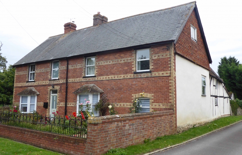
House. C15 origins, late C16 cross-range to rear, C17 alterations, late C19 encasement. Red brick with yellow brick dressings; slate roof; brick ridge stacks to centre, and to left of centre, Originally hall house. 2-storey, 4-window range with cross-wing to rear right. C20 door to left of centre with overlight and segmental brick head. Cl9 angled bays to left and to right of centre, with C20windows, C2O casements to right with C19 surround having seqmental brick head, C20 casements to C19 openings to first floor. Cross-wing to rear is of large timber-framing with roughcast infill. Interior not inspected but noted as having remains of cruck blades and other features. ("Smaller Domestic Architecture and Society in North Berkshire, c.1300-c.1650, with special reference to Steventon", by C.R.J. Currie (Oxford Univ. Ph.D.thesis 1976)
Listing NGR: SU4691991832
External links are from the relevant listing authority and, where applicable, Wikidata. Wikidata IDs may be related buildings as well as this specific building. If you want to add or update a link, you will need to do so by editing the Wikidata entry.


Other nearby listed buildings