Latitude: 51.7805 / 51°46'49"N
Longitude: -1.4854 / 1°29'7"W
OS Eastings: 435596
OS Northings: 209220
OS Grid: SP355092
Mapcode National: GBR 6VS.98F
Mapcode Global: VHC02.6HLX
Plus Code: 9C3WQGJ7+6R
Entry Name: Wall, Gate and Gatepiers Approximately 10 Metres East of the Old Rectory and Borderingfootpath to Church of St Mary
Listing Date: 6 February 1970
Grade: II
Source: Historic England
Source ID: 1053057
English Heritage Legacy ID: 252621
ID on this website: 101053057
Location: Witney, West Oxfordshire, OX28
County: Oxfordshire
District: West Oxfordshire
Civil Parish: Witney
Built-Up Area: Witney
Traditional County: Oxfordshire
Lieutenancy Area (Ceremonial County): Oxfordshire
Church of England Parish: Witney
Church of England Diocese: Oxford
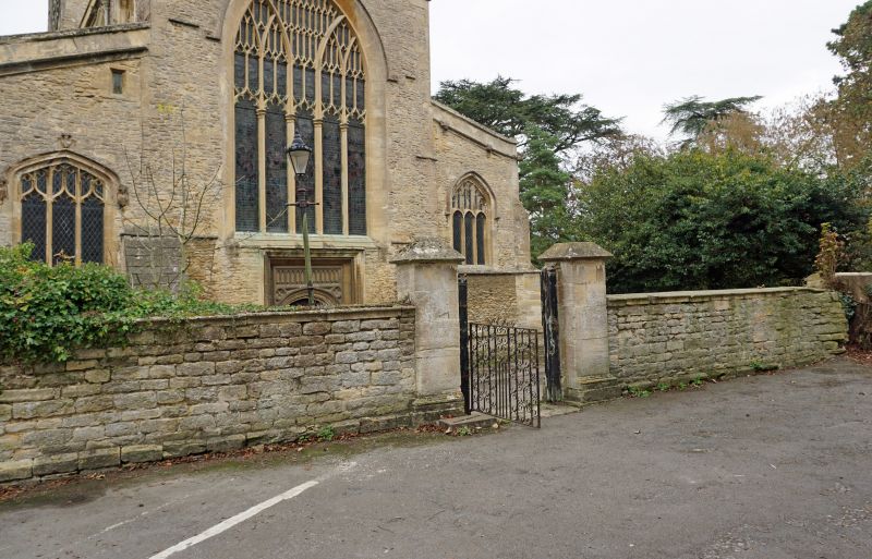
WITNEY CHURCH GREEN SP3509S (South side) 11/78 Wall, gate and gatepiers 06/02/70 approx. 10m. E of The Old Rectory and bordering footpath next to Church of St. Mary (Formerly listed as Front wall and gate piers of the Rectory) GV II
Wall. C18. Coursed limestone rubble and squared coursed limestone with ashlar coping; ashlar gatepiers with pyramidal caps flank wrought-iron gateway between The Old Rectory (q.v.) and Church of St. Mary (q.v.). Included for group value.
Listing NGR: SP3559809220
External links are from the relevant listing authority and, where applicable, Wikidata. Wikidata IDs may be related buildings as well as this specific building. If you want to add or update a link, you will need to do so by editing the Wikidata entry.


Other nearby listed buildings