Approximate Location Map
Large Map »
Latitude: 52.5355 / 52°32'7"N
Longitude: -2.4177 / 2°25'3"W
OS Eastings: 371766
OS Northings: 293156
OS Grid: SO717931
Mapcode National: GBR BZ.F7J8
Mapcode Global: VH90Z.1JQM
Plus Code: 9C4VGHPJ+6W
Entry Name: 14, CARTWAY (See details for further address information)
Listing Date: 1 February 1974
Grade: II
Source: Historic England
Source ID: 1053179
English Heritage Legacy ID: 254358
ID on this website: 101053179
Location: Bridgnorth, Shropshire, WV16
County: Shropshire
Civil Parish: Bridgnorth
Built-Up Area: Bridgnorth
Traditional County: Shropshire
Lieutenancy Area (Ceremonial County): Shropshire
Church of England Parish: Bridgnorth
Church of England Diocese: Hereford
Tagged with: Building
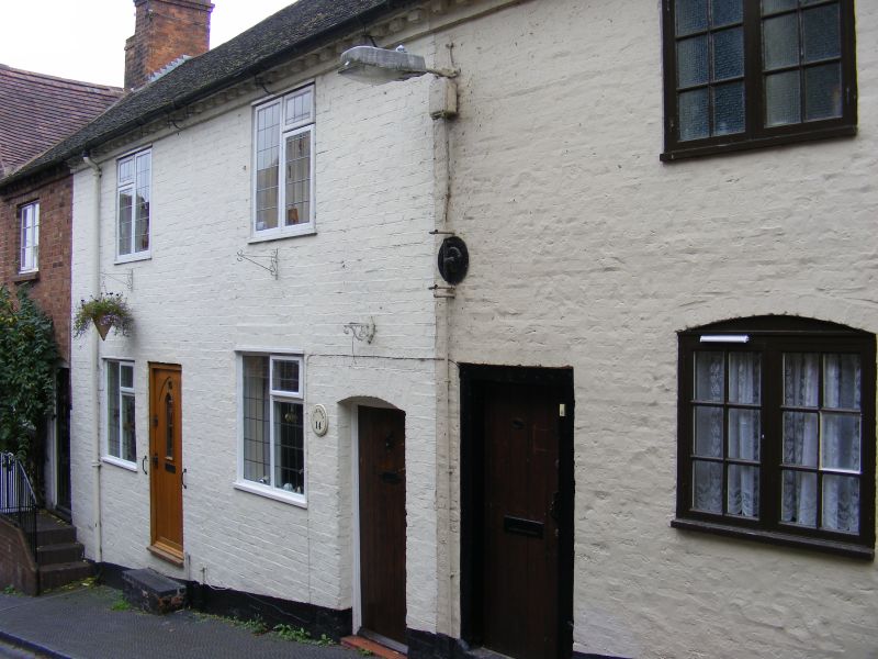
1.
1954 BRIDGNORTH
CARTWAY
(South and
West Side)
No 14
SO 79 SW 2/20
II GV
2.
Early C19 and later, Painted brick; 2 storeys; 2 modern wood casement
windows; plain doorway with cambered head and modern door; dentilled eaves;
tiles. Included for group value.
Methodist Church. Nos 2 to 14 (consec), 16 to 26 (consec) and 29 to 32
(consec) form a group
Listing NGR: SO7176693156
External links are from the relevant listing authority and, where applicable, Wikidata. Wikidata IDs may be related buildings as well as this specific building. If you want to add or update a link, you will need to do so by editing the Wikidata entry.


Other nearby listed buildings
