Approximate Location Map
Large Map »
Latitude: 52.5356 / 52°32'8"N
Longitude: -2.4173 / 2°25'2"W
OS Eastings: 371788
OS Northings: 293163
OS Grid: SO717931
Mapcode National: GBR BZ.F7MJ
Mapcode Global: VH90Z.1JXK
Plus Code: 9C4VGHPM+63
Entry Name: 67, CARTWAY (See details for further address information)
Listing Date: 9 March 1970
Grade: II
Source: Historic England
Source ID: 1053189
English Heritage Legacy ID: 254381
ID on this website: 101053189
Location: Bridgnorth, Shropshire, WV16
County: Shropshire
Civil Parish: Bridgnorth
Built-Up Area: Bridgnorth
Traditional County: Shropshire
Lieutenancy Area (Ceremonial County): Shropshire
Church of England Parish: Bridgnorth
Church of England Diocese: Hereford
Tagged with: Building
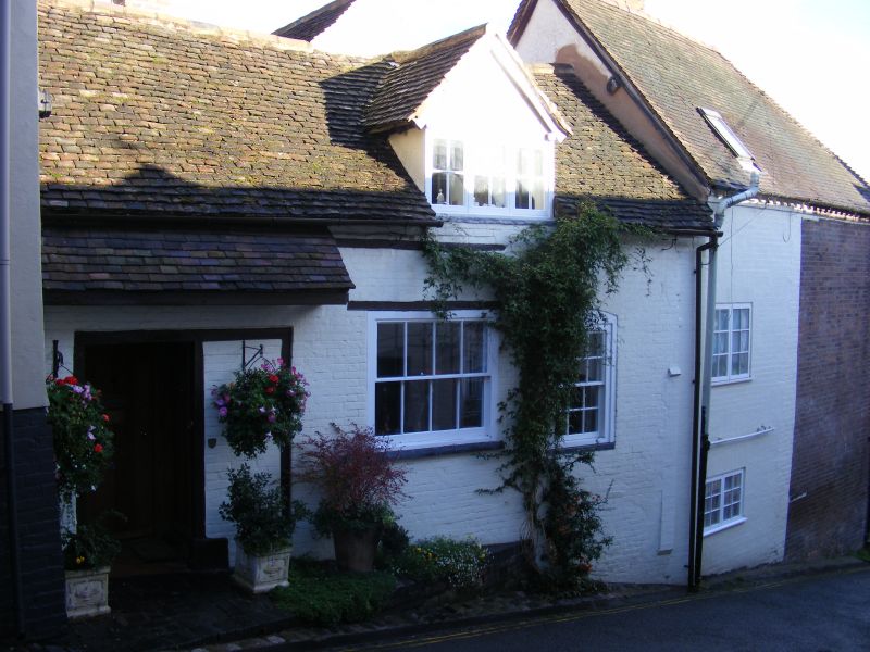
1.
1954 BRIDGNORTH
CARTWAY
(East and
North Side)
No 67
SO 79 SW 2/43 9.3.70.
II GV
2.
C18. Painted brick; one storey and attic; 2 sash windows; plain doorway
with wide tiled canopy, old tile roof with large gabled dormer Ground
floor altered.
Nos 51 to 68 (consec) form a group with Nos 40 to 42 (consec) RIVER SIDE
Listing NGR: SO7178893163
External links are from the relevant listing authority and, where applicable, Wikidata. Wikidata IDs may be related buildings as well as this specific building. If you want to add or update a link, you will need to do so by editing the Wikidata entry.


Other nearby listed buildings
