Approximate Location Map
Large Map »
Latitude: 52.5349 / 52°32'5"N
Longitude: -2.4174 / 2°25'2"W
OS Eastings: 371785
OS Northings: 293084
OS Grid: SO717930
Mapcode National: GBR BZ.FFKL
Mapcode Global: VH90Z.1KW3
Plus Code: 9C4VGHMM+X2
Entry Name: 35 AND 36, CARTWAY (See details for further address information)
Listing Date: 9 March 1970
Grade: II
Source: Historic England
Source ID: 1053183
English Heritage Legacy ID: 254365
ID on this website: 101053183
Location: Bridgnorth, Shropshire, WV16
County: Shropshire
Civil Parish: Bridgnorth
Built-Up Area: Bridgnorth
Traditional County: Shropshire
Lieutenancy Area (Ceremonial County): Shropshire
Church of England Parish: Bridgnorth
Church of England Diocese: Hereford
Tagged with: Building
1.
1954 BRIDGNORTH
CARTWAY
(South and
West Side)
Nos 35 and 36
SO 79 SW 2/27 9.3.70.
II GV
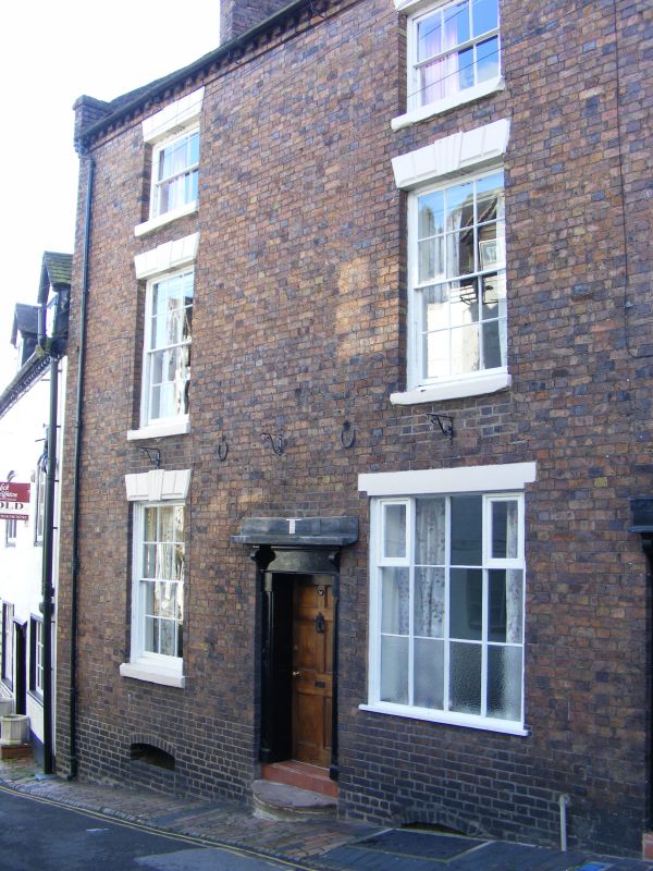
2.
Early C19. Brick; 3 storeys; 3 sash windows with channelled keyblocks
and lintels; 2 moulded wood doorcases; dentilled eaves; tiles.
Nos 34 to 43 (consec) form a group
Listing NGR: SO7178593084
External links are from the relevant listing authority and, where applicable, Wikidata. Wikidata IDs may be related buildings as well as this specific building. If you want to add or update a link, you will need to do so by editing the Wikidata entry.


Other nearby listed buildings
