Approximate Location Map
Large Map »
Latitude: 52.5349 / 52°32'5"N
Longitude: -2.4175 / 2°25'2"W
OS Eastings: 371780
OS Northings: 293090
OS Grid: SO717930
Mapcode National: GBR BZ.FFKK
Mapcode Global: VH90Z.1KV2
Plus Code: 9C4VGHMM+X2
Entry Name: 34, CARTWAY (See details for further address information)
Listing Date: 9 March 1970
Grade: II
Source: Historic England
Source ID: 1177162
English Heritage Legacy ID: 254364
ID on this website: 101177162
Location: Bridgnorth, Shropshire, WV16
County: Shropshire
Civil Parish: Bridgnorth
Built-Up Area: Bridgnorth
Traditional County: Shropshire
Lieutenancy Area (Ceremonial County): Shropshire
Church of England Parish: Bridgnorth
Church of England Diocese: Hereford
Tagged with: Building
1.
1954 BRIDGNORTH
CARTWAY
(South
West Side)
No 34
SO 79 SW 2/26 9.3.70.
II GV
2.
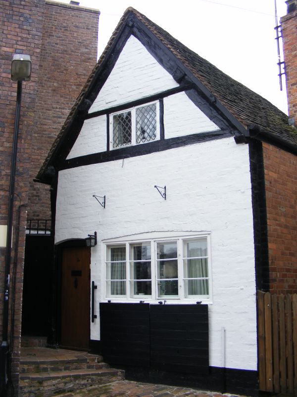
C19 painted brick to earlier timber frame; single storey plus attic gable;
1 casement window; early C19 plain doorcase; tiles. Side faced with red
brick; timbers exposed in gable only.
Nos 34 to 43 (consec) form a group
Listing NGR: SO7178093090
External links are from the relevant listing authority and, where applicable, Wikidata. Wikidata IDs may be related buildings as well as this specific building. If you want to add or update a link, you will need to do so by editing the Wikidata entry.


Other nearby listed buildings
