Latitude: 51.6904 / 51°41'25"N
Longitude: -1.6387 / 1°38'19"W
OS Eastings: 425070
OS Northings: 199135
OS Grid: SU250991
Mapcode National: GBR 5V7.SNG
Mapcode Global: VHC0C.KS10
Plus Code: 9C3WM9R6+5G
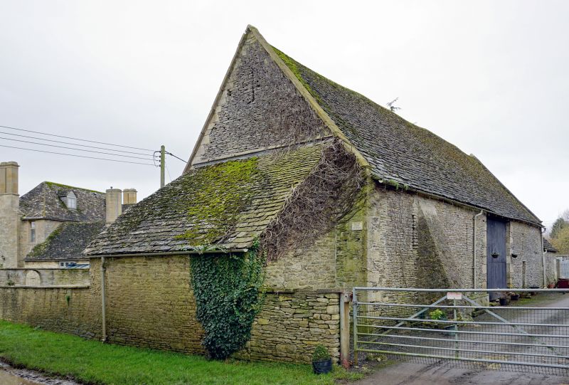
Entry Name: Barn Approximately 15 Metres North of Manor Farmhouse
Listing Date: 12 September 1955
Last Amended: 30 March 1989
Grade: II
Source: Historic England
Source ID: 1053378
English Heritage Legacy ID: 253828
ID on this website: 101053378
Location: Kelmscott, West Oxfordshire, GL7
County: Oxfordshire
District: West Oxfordshire
Civil Parish: Kelmscott
Traditional County: Oxfordshire
Lieutenancy Area (Ceremonial County): Oxfordshire
Church of England Parish: Broadwell with Kelmscott
Church of England Diocese: Oxford
Tagged with: Barn
KELMSCOTT Barn approx. 15m N of Manor SU2499-2599 10/76 Farmhouse 12.9.55 (Formerly listed as part of Manor Farmhouse with Barn and, Cowsheds to SE, Dovecote, Barn to N, Barn and Cowsheds to SW) GV II
Barn. Early C18 extended late C18 with later additions and alterations. Roughly coursed limestone rubble with alternating angle quoins; stone slate roofs with coped verges to main range. This has wide full-height doorway with alternating angle quoins and wood lintel to left of centre; C20 double doors. Opposing entrance to rear and lower-infilled doorway with wood lintel to far left. Narrow rectangular air vents some infilled. Low gabled range added to left in late C18 has front rebuilt in C19; plank door to left. Interior. Main range has triple-purlin collar and tie beam roof in 6 bays with raking struts from tie beams to principal rafters. Air vents splayed internally and stone threshing floor. [2371]
Listing NGR: SU2507099135
External links are from the relevant listing authority and, where applicable, Wikidata. Wikidata IDs may be related buildings as well as this specific building. If you want to add or update a link, you will need to do so by editing the Wikidata entry.


Other nearby listed buildings