Latitude: 51.7359 / 51°44'9"N
Longitude: -1.5864 / 1°35'11"W
OS Eastings: 428657
OS Northings: 204211
OS Grid: SP286042
Mapcode National: GBR 5TX.1RQ
Mapcode Global: VHC06.GM6M
Plus Code: 9C3WPCP7+9C
Entry Name: Group of 4 Chest Tombs 6-15 Metres to South of South Porch of Church of St Mary
Listing Date: 4 May 1989
Grade: II
Source: Historic England
Source ID: 1053518
English Heritage Legacy ID: 253467
ID on this website: 101053518
Location: St Mary's Church, Black Bourton, West Oxfordshire, OX18
County: Oxfordshire
District: West Oxfordshire
Civil Parish: Black Bourton
Traditional County: Oxfordshire
Lieutenancy Area (Ceremonial County): Oxfordshire
Church of England Parish: Black Bourton
Church of England Diocese: Oxford
Tagged with: Chest tomb
SP2804-2904 CARTERTON AND BLACK BOURTON BURFORD ROAD (West side) Black Bourton 10/155 Group of 4 chest tombs 6-15m to S of S porch of Church of St. Mary
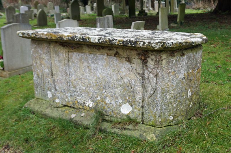
GV II Group of 4 chest tombs, all of limestone: 1) to Thomas Clark, 1804. Moulded base, flat cornice lid, recessed corners with square pilasters carrying carved reliefs of ornamental drapes. Inscription tablets are oval and have shallow relief carvings of cherub heads and foliage in spandrels. 2) to John Cox, 1827. Moulded base, flat cornice lid, recessed corners with square balusters, oval panels with worn inscriptions. 3) Late C17-C18 chest with illegible inscriptions, plain slab sides, and flat cornice lid with cyma recta moulding. 4) C18-early C19 chest with illegible inscriptions and canted west end. Plain slab sides, the north side incorporating moulded panel. Flat lid with chamfered lower edge.
Listing NGR: SP2865704211
External links are from the relevant listing authority and, where applicable, Wikidata. Wikidata IDs may be related buildings as well as this specific building. If you want to add or update a link, you will need to do so by editing the Wikidata entry.


Other nearby listed buildings