Latitude: 52.5361 / 52°32'10"N
Longitude: -2.4213 / 2°25'16"W
OS Eastings: 371518
OS Northings: 293222
OS Grid: SO715932
Mapcode National: GBR BZ.F6MB
Mapcode Global: VH83H.ZJ95
Plus Code: 9C4VGHPH+CF
Entry Name: 66-68, Whitburn Street
Listing Date: 19 December 1988
Grade: II
Source: Historic England
Source ID: 1053717
English Heritage Legacy ID: 255079
ID on this website: 101053717
Location: High Town, Shropshire, WV16
County: Shropshire
Civil Parish: Bridgnorth
Built-Up Area: Bridgnorth
Traditional County: Shropshire
Lieutenancy Area (Ceremonial County): Shropshire
Church of England Parish: Bridgnorth
Church of England Diocese: Hereford
Tagged with: Building
The following buildings shall be included:
1. 5357 BRIDGNORTH WHITBURN STREET (south side)
SO 79 SW 2/283 Nos 66, 67 and 68
II GV
2.
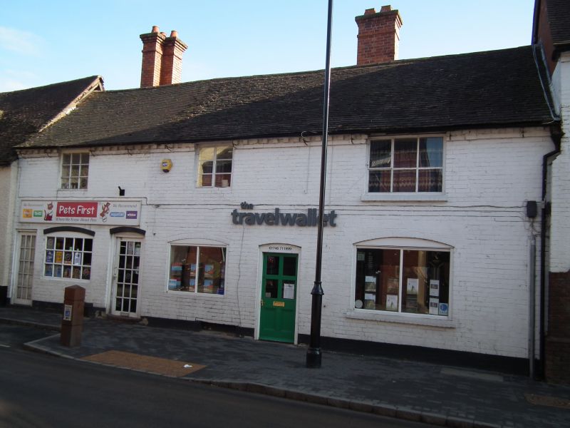
Shops and dwellings. C18 with C19 alterations. Painted brick to front, red brick to rear. Plain-tile roof with tall rear L-plan stacks. Brick dentilled eaves. 2-storey 3-window range of two 2-light casements and a 3-light casement to right. On ground floor, from left, C20 door, 3-light casement, further door, 2-light casement, 6-panel door and C19 shop window with glazing-bar sashes. Entrance to No 66 down alley on right end. Wings to rear mainly with 2-light casements. Interiors: No 66 has blocked corner open fireplace back-to-back with that in No 67. Hood to fireplace and old purlin visible on 1st floor. No 67 has chamfered beam with ogee stops to ground floor, blocked fireplace and hood. Roof not visible. No 68 noted as having ceiling beams.
Listing NGR: SO7151893222
External links are from the relevant listing authority and, where applicable, Wikidata. Wikidata IDs may be related buildings as well as this specific building. If you want to add or update a link, you will need to do so by editing the Wikidata entry.


Other nearby listed buildings