Approximate Location Map
Large Map »
Latitude: 52.5871 / 52°35'13"N
Longitude: -2.3382 / 2°20'17"W
OS Eastings: 377186
OS Northings: 298859
OS Grid: SO771988
Mapcode National: GBR 07T.X93
Mapcode Global: WH9DR.17WJ
Plus Code: 9C4VHMP6+RP
Entry Name: Ackleton House
Listing Date: 9 March 1970
Grade: II
Source: Historic England
Source ID: 1053721
English Heritage Legacy ID: 254985
ID on this website: 101053721
Location: Ackleton, Shropshire, WV6
County: Shropshire
Civil Parish: Worfield
Built-Up Area: Ackleton
Traditional County: Shropshire
Lieutenancy Area (Ceremonial County): Shropshire
Church of England Parish: Worfield
Church of England Diocese: Hereford
Tagged with: House
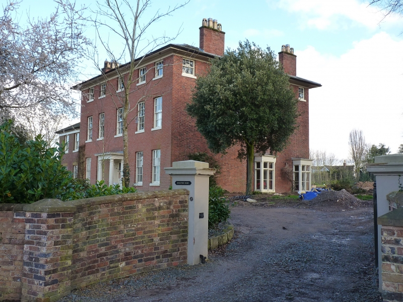
1.
1954 WORFIELD ACKLETON
Ackleton House
SO 79 NE 16/33 9.3.70.
II
2.
Late C18. Brick with hipped tiled roof, deep eaves and brick stacks;
3 storeys; 5 sash windows to front. Doric pillared porch with dentilled
cornice. Lower wing on left.
Listing NGR: SO7718698859
External links are from the relevant listing authority and, where applicable, Wikidata. Wikidata IDs may be related buildings as well as this specific building. If you want to add or update a link, you will need to do so by editing the Wikidata entry.


Other nearby listed buildings
