Approximate Location Map
Large Map »
Latitude: 52.595 / 52°35'42"N
Longitude: -2.5553 / 2°33'18"W
OS Eastings: 362484
OS Northings: 299838
OS Grid: SO624998
Mapcode National: GBR BS.9PLR
Mapcode Global: WH9DM.Q1DD
Plus Code: 9C4VHCWV+2V
Entry Name: No. 11 Barrow Street
Listing Date: 1 February 1974
Grade: II
Source: Historic England
Source ID: 1053844
English Heritage Legacy ID: 254770
ID on this website: 101053844
Location: Much Wenlock, Shropshire, TF13
County: Shropshire
Civil Parish: Much Wenlock
Built-Up Area: Much Wenlock
Traditional County: Shropshire
Lieutenancy Area (Ceremonial County): Shropshire
Church of England Parish: Much Wenlock with Bourton
Church of England Diocese: Hereford
Tagged with: Building
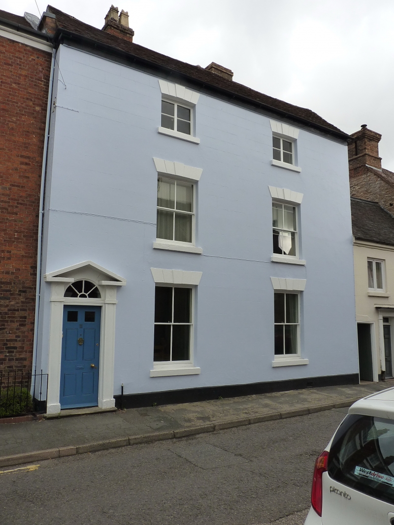
SO 69 NW (SJ 6200); 6/8
MUCH WENLOCK,
BARROW STREET (North Side),
No. 11
GV
II
Circa 1800. Stucco; three storeys; two sash windows (single glazing bars) with
channelled lintels; moulded wood pilaster doorcase with open pediment
and segmental fanlight; plain eaves; tiles.
Nos. 6 to 9 (consec) and 11 to 14 (consec) form a group
Listing NGR: SO6248899840
External links are from the relevant listing authority and, where applicable, Wikidata. Wikidata IDs may be related buildings as well as this specific building. If you want to add or update a link, you will need to do so by editing the Wikidata entry.


Other nearby listed buildings
