Latitude: 52.5402 / 52°32'24"N
Longitude: -2.3396 / 2°20'22"W
OS Eastings: 377066
OS Northings: 293652
OS Grid: SO770936
Mapcode National: GBR 08D.PBP
Mapcode Global: VH910.DFJ0
Plus Code: 9C4VGMR6+35
Entry Name: High Grosvenor
Listing Date: 9 March 1970
Grade: II
Source: Historic England
Source ID: 1053913
English Heritage Legacy ID: 254628
ID on this website: 101053913
Location: Woundale, Shropshire, WV15
County: Shropshire
Civil Parish: Claverley
Traditional County: Shropshire
Lieutenancy Area (Ceremonial County): Shropshire
Church of England Parish: Claverley
Church of England Diocese: Hereford
Tagged with: Building
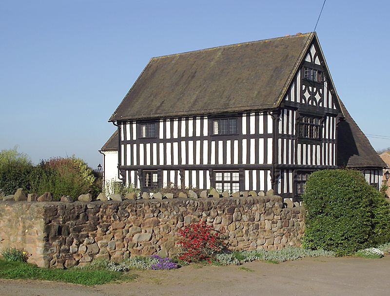
1.
1954 CLAVERLEY
High Grosvenor
SO 79 SE 23/37 9.3.70.
II
2.
C16 and later. The front wing timber framed with painted plaster infilling,
closely spaced vertical framing and carved brackets to continuous overhang
towards road; old ridge tiled roof; interesting gabled ends; 1st floor
and attic overhangs; several original window frames, mostly bricked up
and later casements inserted.
Listing NGR: SO7706693652
External links are from the relevant listing authority and, where applicable, Wikidata. Wikidata IDs may be related buildings as well as this specific building. If you want to add or update a link, you will need to do so by editing the Wikidata entry.


Other nearby listed buildings