Approximate Location Map
Large Map »
Latitude: 52.6155 / 52°36'55"N
Longitude: -2.4442 / 2°26'38"W
OS Eastings: 370024
OS Northings: 302064
OS Grid: SJ700020
Mapcode National: GBR BY.870M
Mapcode Global: WH9DH.FJB7
Plus Code: 9C4VJH84+68
Entry Name: Wards Tyning
Listing Date: 22 January 1975
Grade: II
Source: Historic England
Source ID: 1054164
English Heritage Legacy ID: 362014
ID on this website: 101054164
Location: Coalport, Telford and Wrekin, Shropshire, TF8
County: Telford and Wrekin
Civil Parish: The Gorge
Traditional County: Shropshire
Lieutenancy Area (Ceremonial County): Shropshire
Church of England Parish: Broseley with Benthall and Jackfield
Church of England Diocese: Hereford
Tagged with: Building
COALPORT BROSELEY ROAD
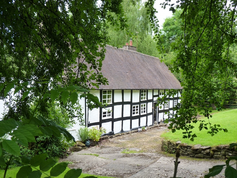
1.
5362 Wards Tyning
SJ 70 SW 34/150 22.1.75
II
2.
Circa C16 hall house. Timber framed with painted brick infill panels. Steeply
pitched plain tile roof with gabled ends. Floored in circa C17 and now 2 storeys.
Long 5/6-window range. Modern casements and modern door off centre. five gables
and outshut on north elevation.
Central timber framed chimney stack with brick top stage.
Listing NGR: SJ7002402064
External links are from the relevant listing authority and, where applicable, Wikidata. Wikidata IDs may be related buildings as well as this specific building. If you want to add or update a link, you will need to do so by editing the Wikidata entry.


Other nearby listed buildings
