Latitude: 52.8184 / 52°49'6"N
Longitude: -3.0198 / 3°1'11"W
OS Eastings: 331368
OS Northings: 325027
OS Grid: SJ313250
Mapcode National: GBR 74.VJZ7
Mapcode Global: WH8B3.LF66
Plus Code: 9C4RRX9J+93
Entry Name: Navigation Inn and Attached Warehouse
Listing Date: 15 May 1986
Grade: II
Source: Historic England
Source ID: 1054272
English Heritage Legacy ID: 255664
ID on this website: 101054272
Location: Maesbury Marsh, Shropshire, SY10
County: Shropshire
Civil Parish: Oswestry Rural
Traditional County: Shropshire
Lieutenancy Area (Ceremonial County): Shropshire
Church of England Parish: Maesbury St John the Baptist
Church of England Diocese: Lichfield
Tagged with: Building
SJ 32 NW OSWESTRY RURAL C.P. MAESBURY MARSH
6/187 Navigation Inn and attached warehouse
GV II
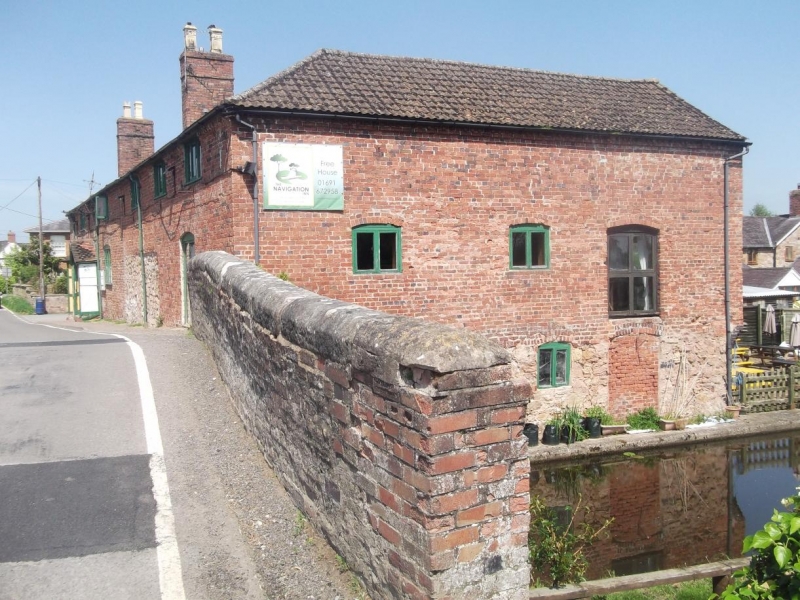
Inn and attached warehouse. Circa 1796 with later additions and alterations. Red brick, rendered and painted to front, pantile roof with two C19 purplish red brick ridge stacks to inn. L-plan with warehouse flanking canal. 2 storeys, dentilled eaves cornice; inn to left has angled north end with panelled double doors under C20 porch, large fixed-light windows to left and right with C20 gabled dormer breaking eaves; road front has C19 casements to left and right of C20 door under gabled timber porch, those to ground floor with segmental heads. Warehouse: attached to right has segmental-headed doorway and two C19 casements directly below eaves to left and right (as on inn); segmental-headed doorways on ground and first floors on canal side (former now blocked). This section of the Ellesmere Canal, opened in 1796 to link with the Montgomeryshire Canal at Carreghofa, was used to transport limestone from the quarries at Llanymynech and became part of the Shropshire Union in 1846. Included for group value. Charles Hadfield, The Canals of the West Midlands (1966), p. 170.
Listing NGR: SJ3136825027
External links are from the relevant listing authority and, where applicable, Wikidata. Wikidata IDs may be related buildings as well as this specific building. If you want to add or update a link, you will need to do so by editing the Wikidata entry.


Other nearby listed buildings