Approximate Location Map
Large Map »
Latitude: 53.3769 / 53°22'36"N
Longitude: -2.0022 / 2°0'7"W
OS Eastings: 399952
OS Northings: 386668
OS Grid: SJ999866
Mapcode National: GBR GYGD.B6
Mapcode Global: WHBB5.6DV2
Plus Code: 9C5V9XGX+P4
Entry Name: Fold House
Listing Date: 19 September 1977
Grade: II
Source: Historic England
Source ID: 1054710
English Heritage Legacy ID: 81866
ID on this website: 101054710
Location: Hidebank, High Peak, Derbyshire, SK22
County: Derbyshire
District: High Peak
Civil Parish: New Mills
Traditional County: Derbyshire
Lieutenancy Area (Ceremonial County): Derbyshire
Church of England Parish: New Mills St George
Church of England Diocese: Derby
Tagged with: House
NEW MILLS WHITLE BANK ROAD
1.
5172
(North Side)
Fold House
SJ 98 NE 2/56
II GV
2.
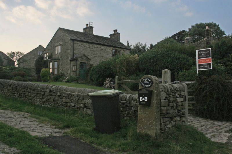
C18 cottage of 2 storeys in coursed stone with stone slate roof with 2 stacks.
Rusticated quoins. Modern stone porch. 1 window above 1, formerly of 3 lights
with stone mullions, now with wood mullions. C19 canted bay window to gable end
below window of 3 lights. Included for group value.
Listing NGR: SJ9995286668
External links are from the relevant listing authority and, where applicable, Wikidata. Wikidata IDs may be related buildings as well as this specific building. If you want to add or update a link, you will need to do so by editing the Wikidata entry.


Other nearby listed buildings
