Latitude: 52.6278 / 52°37'40"N
Longitude: -2.85 / 2°50'59"W
OS Eastings: 342564
OS Northings: 303682
OS Grid: SJ425036
Mapcode National: GBR BD.7H1W
Mapcode Global: WH8C5.664R
Plus Code: 9C4VJ5H2+42
Entry Name: Wrentnall Cottages
Listing Date: 10 March 1986
Grade: II
Source: Historic England
Source ID: 1055083
English Heritage Legacy ID: 259332
ID on this website: 101055083
Location: Wrentnall, Shropshire, SY5
County: Shropshire
Civil Parish: Church Pulverbatch
Traditional County: Shropshire
Lieutenancy Area (Ceremonial County): Shropshire
Church of England Parish: Church Pulverbatch
Church of England Diocese: Hereford
Tagged with: Cottage
SJ 40 SW CHURCH PULVERBATCH C.P. WRENTNALL
8/31 Nos.1 and 2, - Wrentnall Cottages
- II
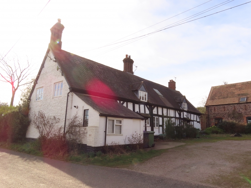
Farmhouse, now divided into 2 cottages. Mid-C17 with later additions and alterations. Timber framed with painted brick infill, machine tile roof. One storey and attic; 4 framed bays; framing: square panels, 3 from cill to wall-plate with short straight tension braces from wall posts, bottom 2 panels partly replaced by high brick plinth to front; right gable end clad in uncoursed limestone rubble; irregular fenestration, two 3-light late C19 casements to either side of boarded door to left with 2 to either side of boarded door to right, both doors with late C20 gabled hoods, three C20 gabled eaves dormers, 2 to left and one to right; central late C19 grey/ brown brick ridge stack with integral end stacks to left and right.
Listing NGR: SJ4256403682
External links are from the relevant listing authority and, where applicable, Wikidata. Wikidata IDs may be related buildings as well as this specific building. If you want to add or update a link, you will need to do so by editing the Wikidata entry.


Other nearby listed buildings