Latitude: 52.2905 / 52°17'25"N
Longitude: -1.2126 / 1°12'45"W
OS Eastings: 453803
OS Northings: 266114
OS Grid: SP538661
Mapcode National: GBR 8RM.68P
Mapcode Global: VHCV4.XPTF
Plus Code: 9C4W7QRP+6X
Entry Name: Checkley Close and Attached Wall
Listing Date: 11 March 1987
Grade: II
Source: Historic England
Source ID: 1055869
English Heritage Legacy ID: 360987
ID on this website: 101055869
Location: Braunston, West Northamptonshire, NN11
County: West Northamptonshire
Civil Parish: Braunston
Built-Up Area: Braunston
Traditional County: Northamptonshire
Lieutenancy Area (Ceremonial County): Northamptonshire
Church of England Parish: Braunston All Saints
Church of England Diocese: Peterborough
Tagged with: Building
BRAUNSTON HIGH STREET SP5366 (South side) 18/99 Checkley Close and attached wall
- II
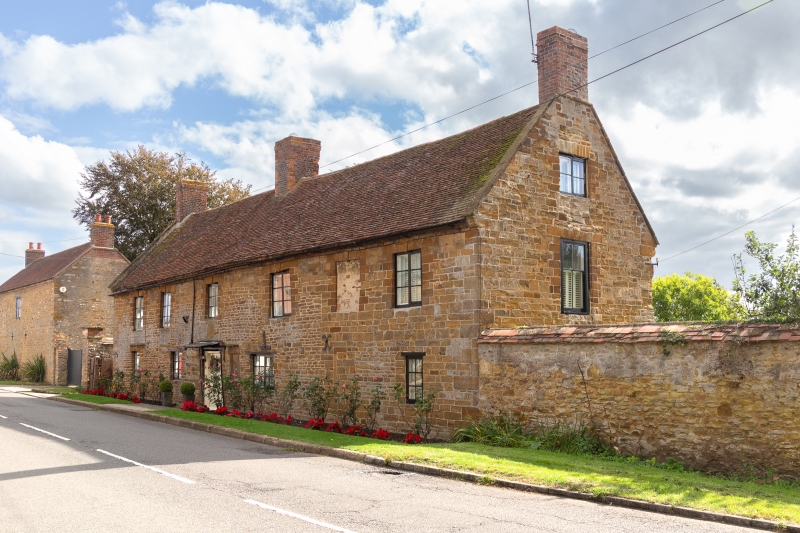
House. C17, remodelled early C18 and extended 2 bays to right. Coursed limestone and ironstone rubble, tile roof, brick stacks. 2 storeys and attic; 6 bays. Doorway in third bay form left has wood lintel and C20 door. 2-light casement window in plain stone surround with old iron casement in left bay. 2-light casement window with wood lintel in second bay from left. Blocked one-light window with moulded stone surround to right of entrance. 2-light casement window with wood lintel to right and one-light window with wood lintel in right bay. 2-light casement windows with stone lintels with keyblocks to first floor, that in second bay from the right is blocked. Nogged brick cornice. Coped gable ends with kneelers. Interior not inspected. Wall extending from right side, probably C18. Coursed limestone and ironstone rubble, tile coping.
Listing NGR: SP5380366114
External links are from the relevant listing authority and, where applicable, Wikidata. Wikidata IDs may be related buildings as well as this specific building. If you want to add or update a link, you will need to do so by editing the Wikidata entry.


Other nearby listed buildings