Latitude: 52.9703 / 52°58'13"N
Longitude: -2.6819 / 2°40'54"W
OS Eastings: 354303
OS Northings: 341658
OS Grid: SJ543416
Mapcode National: GBR 7L.JWKJ
Mapcode Global: WH89H.SL3R
Plus Code: 9C4VX8C9+47
Entry Name: 21, Saint Johns Street
Listing Date: 1 May 1951
Grade: II
Source: Historic England
Source ID: 1055953
English Heritage Legacy ID: 260667
ID on this website: 101055953
Location: Whitchurch, Shropshire, SY13
County: Shropshire
Civil Parish: Whitchurch Urban
Built-Up Area: Whitchurch
Traditional County: Shropshire
Lieutenancy Area (Ceremonial County): Shropshire
Church of England Parish: Whitchurch St Alkmund
Church of England Diocese: Lichfield
Tagged with: Building
WHITCHURCH URBAN C.P. SAINT JOHN'S STREET (south- SJ 5441 east side) 8/111 No. 21 1.5.51 - II
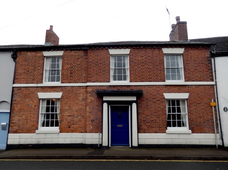
House. Circa 1840. Red brick with some painted stone dressings. Graded slate roof. 2 storeys. Plinth with chamfered rustication , first-floor moulded cill band, and dentil brick eaves cornice. Integral brick end stacks. 1:2 bays, set back to left; glazing bar sashes (16-pane to ground floor) with painted stone cills and lintels. Central 6-panelled door (lower 2 flush and upper 2 glazed) with Ionic stone doorcase consisting of unfluted three-quarter columns supporting frieze and moulded cornice. Interior not inspected.
Listing NGR: SJ5430341658
External links are from the relevant listing authority and, where applicable, Wikidata. Wikidata IDs may be related buildings as well as this specific building. If you want to add or update a link, you will need to do so by editing the Wikidata entry.


Other nearby listed buildings