Latitude: 51.3272 / 51°19'37"N
Longitude: 1.4021 / 1°24'7"E
OS Eastings: 637113
OS Northings: 164172
OS Grid: TR371641
Mapcode National: GBR X0L.M9M
Mapcode Global: VHMCW.8W2Y
Plus Code: 9F338CG2+VR
Entry Name: The Lido, boating pond and retaining walls.
Listing Date: 4 February 1988
Grade: II
Source: Historic England
Source ID: 1057651
English Heritage Legacy ID: 171976
ID on this website: 101057651
Location: Pegwell, Thanet, Kent, CT11
County: Kent
District: Thanet
Town: Thanet
Civil Parish: Ramsgate
Built-Up Area: Ramsgate
Traditional County: Kent
Lieutenancy Area (Ceremonial County): Kent
Tagged with: Building
This list entry was subject to a Minor Enhancement on 5 March 2024 to amend name of architect and date of construction, to add two references to Selected sources and to reformat the text to current standards
TR 3764 SW
17/340
RAMSGATE
ROYAL ESPLANADE (south side) The Lido, boating pond and retaining walls.
GV
II
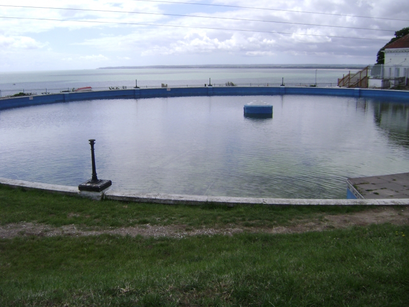
Bandstand and terraces, now boating pool and Leisure Park.1928-29 by Basil C. Deacon of Franklin and Deacon of Luton. Rendered brick, low retaining wall to roadside, with flights of stairs and side walls and central semi-circular flight all leading to terrace, with central boating pond with fountain, the retaining wall with cast iron lamp standards. This circular enclosure was originally a dance floor with central bandstand until converted after World War II. A bronze plaque on the lower boundary wall records the opening of the Royal Esplanade and undercliff by the Prince of Wales, 1926. Flanked by sun- shelters and cafe (see separate items).
Listing NGR: TR3711364172
This list entry was subject to a Minor Enhancement on 5 March 2024 to amend name of architect and date of construction, to add two references to Selected sources and to reformat the text to current standards
TR 3764 SW
17/340
RAMSGATE
ROYAL ESPLANADE (south side)
The Lido, boating pond and retaining walls.
GV
II
Bandstand and terraces, now boating pool and Leisure Park.1928-29 by Basil C. Deacon of Franklin and Deacon of Luton. Rendered brick, low retaining wall to roadside, with flights of stairs and side walls and central semi-circular flight all leading to terrace, with central boating pond with fountain, the retaining wall with cast iron lamp standards. This circular enclosure was originally a dance floor with central bandstand until converted after World War II. A bronze plaque on the lower boundary wall records the opening of the Royal Esplanade and undercliff by the Prince of Wales, 1926. Flanked by sun- shelters and cafe (see separate items).
Listing NGR: TR3711364172
External links are from the relevant listing authority and, where applicable, Wikidata. Wikidata IDs may be related buildings as well as this specific building. If you want to add or update a link, you will need to do so by editing the Wikidata entry.


Other nearby listed buildings