Latitude: 51.2315 / 51°13'53"N
Longitude: -2.3239 / 2°19'25"W
OS Eastings: 377483
OS Northings: 148083
OS Grid: ST774480
Mapcode National: GBR 0S9.M9L
Mapcode Global: VH97D.N9TS
Plus Code: 9C3V6MJG+HF
Entry Name: Former Sunday School
Listing Date: 16 February 1983
Grade: II
Source: Historic England
Source ID: 1057749
English Heritage Legacy ID: 266374
ID on this website: 101057749
Location: Frome, Somerset, BA11
County: Somerset
District: Mendip
Civil Parish: Frome
Built-Up Area: Frome
Traditional County: Somerset
Lieutenancy Area (Ceremonial County): Somerset
Tagged with: Building
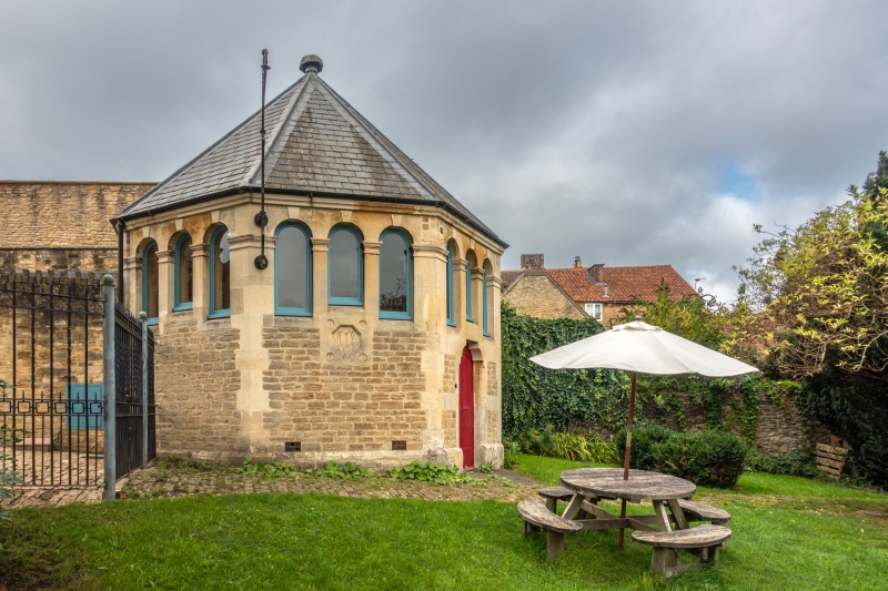
1.
5363 WHITTOX LANE
Former Sunday School
ST 7748 SW 4/437A GV
II
2.
Octagonal detached building or rubble with pyramidal tiled roof to south-east.
Date in roundel on east side 1875. Interior: pointed plaster dome on exposed
rafters, some of the old bench arrangement can be seen. A rare survival of the
type.
Listing NGR: ST7748348083
External links are from the relevant listing authority and, where applicable, Wikidata. Wikidata IDs may be related buildings as well as this specific building. If you want to add or update a link, you will need to do so by editing the Wikidata entry.


Other nearby listed buildings