Approximate Location Map
Large Map »
Latitude: 51.1482 / 51°8'53"N
Longitude: -2.7137 / 2°42'49"W
OS Eastings: 350171
OS Northings: 139011
OS Grid: ST501390
Mapcode National: GBR MK.7Y0Y
Mapcode Global: VH8B3.XD6N
Plus Code: 9C3V47XP+7G
Entry Name: 51, High Street
Listing Date: 15 March 1974
Grade: II
Source: Historic England
Source ID: 1057928
English Heritage Legacy ID: 265933
ID on this website: 101057928
Location: Glastonbury, Somerset, BA6
County: Somerset
District: Mendip
Civil Parish: Glastonbury
Built-Up Area: Glastonbury
Traditional County: Somerset
Lieutenancy Area (Ceremonial County): Somerset
Tagged with: Building
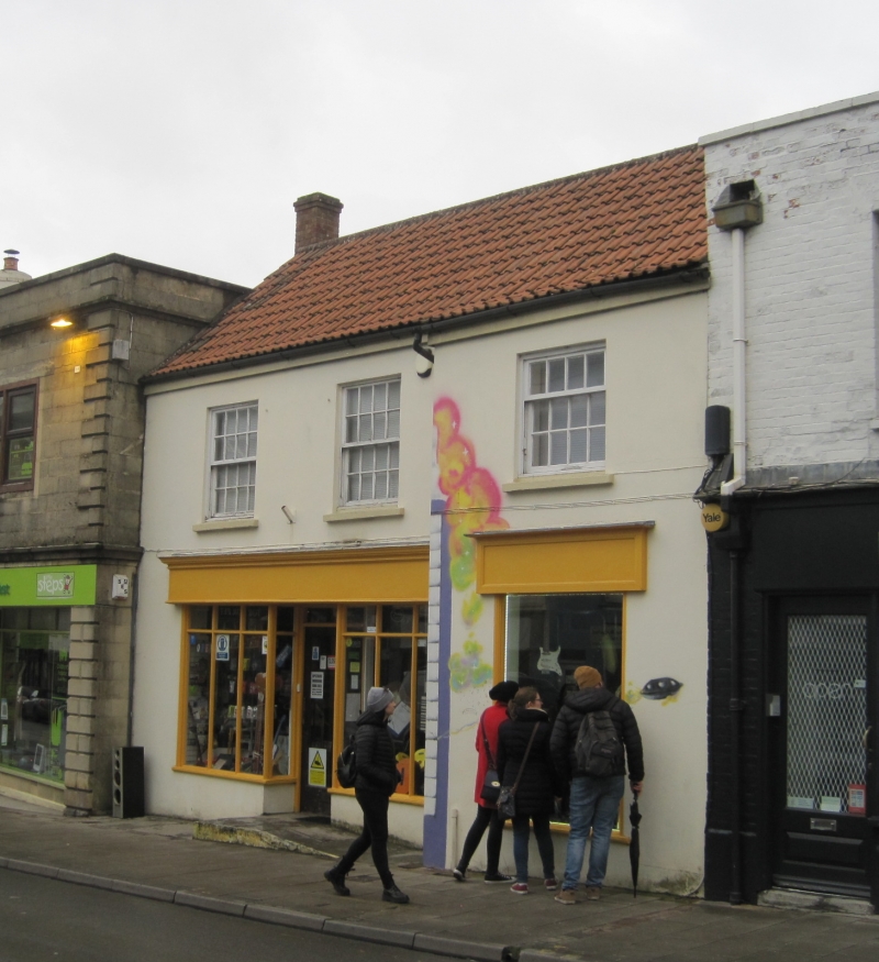
HIGH STREET
1.
1133
(North Side)
No 51
ST 5039 6/45
II GV
2.
Late C17/early C18. 2 storeys. Cement-rendered and colourwashed front, part to
right breaking forward. Pantile roof, projecting eaves. 3 wood mullioned casements
to 1st floor, 2, 3 and 4 lights without glazing bars. 2 shop-windows, one on return
wall to right.
Nos 5l to 69 (odd) form a group.
Listing NGR: ST5017039015
External links are from the relevant listing authority and, where applicable, Wikidata. Wikidata IDs may be related buildings as well as this specific building. If you want to add or update a link, you will need to do so by editing the Wikidata entry.


Other nearby listed buildings
