Approximate Location Map
Large Map »
Latitude: 51.1482 / 51°8'53"N
Longitude: -2.7136 / 2°42'48"W
OS Eastings: 350182
OS Northings: 139011
OS Grid: ST501390
Mapcode National: GBR MK.7Y27
Mapcode Global: VH8B3.XD9N
Plus Code: 9C3V47XP+7H
Entry Name: 53-57, High Street
Listing Date: 15 March 1974
Grade: II
Source: Historic England
Source ID: 1345426
English Heritage Legacy ID: 265934
ID on this website: 101345426
Location: Glastonbury, Somerset, BA6
County: Somerset
District: Mendip
Civil Parish: Glastonbury
Built-Up Area: Glastonbury
Traditional County: Somerset
Lieutenancy Area (Ceremonial County): Somerset
Tagged with: Building
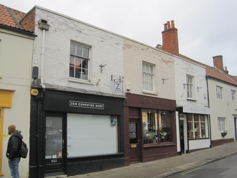
HIGH STREET
1.
1133
(North Side)
Nos 53 to 57 (odd)
ST 5039 6/184
II GV
2.
Small row of cottages. Probably late C17/early C18, later fronts. 2 storeys.
Painted brick. Irregular pantile roof to all 3 properties. Parapet. 3 windows.
Sashes in plain reveals, thin glazing bars. Variety of modern shop-fronts.
Nos 51 to 69 (odd) form a group.
Listing NGR: ST5017639014
External links are from the relevant listing authority and, where applicable, Wikidata. Wikidata IDs may be related buildings as well as this specific building. If you want to add or update a link, you will need to do so by editing the Wikidata entry.


Other nearby listed buildings
