Latitude: 51.6456 / 51°38'44"N
Longitude: -1.0061 / 1°0'22"W
OS Eastings: 468863
OS Northings: 194555
OS Grid: SU688945
Mapcode National: GBR B1Y.Y56
Mapcode Global: VHDVT.HWYW
Plus Code: 9C3WJXWV+6G
Entry Name: The Well House Hotel and Restaurant
Listing Date: 11 December 1985
Grade: II
Source: Historic England
Source ID: 1059409
English Heritage Legacy ID: 247654
ID on this website: 101059409
Location: Watlington, South Oxfordshire, OX49
County: Oxfordshire
District: South Oxfordshire
Civil Parish: Watlington
Built-Up Area: Watlington
Traditional County: Oxfordshire
Lieutenancy Area (Ceremonial County): Oxfordshire
Church of England Parish: Watlington
Church of England Diocese: Oxford
Tagged with: Building
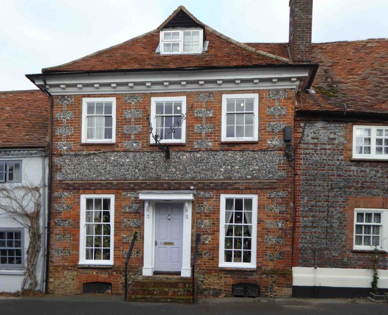
WATLINGTON HIGH STREET SU6894 (North side) 6/183 Nos.34 and 36 (The Well House Hotel and Restaurant)
GV II
House, now flat, hotel and restaurant. C16, remodelled and refronted in early C18. Originally timber-framed. Front of knapped flint rubble with brick quoins and dressings; hipped old tile roof; brick rear end stack. Original plan form not determined. 2 storeys, basement and attic; 3-window range. Flat hood over C20 door. Brick segmental arched cellar windows; C20 flat arches over C20 sashes on ground floor, and on first-floor flat brick arches over horned sashes. Chequer brick storey band; moulded and modillioned wood cornice; C20 gabled roof dormer. C20 rear extension. Interior: early C18 cellar. Exposed timber framing and transverse beams with mortices; first-floor room to rear has arch-braced tie beam. Quarter-turn stairs to rear right. Eaves raised and collar-truss roof built in early C18. C16 house extended further to rear and was connected to front range by a first-floor gallery on the right. No.36 to left: C17, remodelled in late C18. Originally timber-framed. Front of late C18 colourwashed brick; timber framing to rear; gabled old tile roof; brick rear lateral stack. 2-unit plan. 2 storeys; 3-window range. Rendered flat brick arches over C20 door and 8-pane horned sashes; flat brick arches over late C19 two-light first-floor casements. Dentilled eaves. C20 rear extensions. C19/C20 left extension not of special architectural interest. Interior: exposed timber framing to rear. Beams of late C18 raised first floor. Late C18 quarter-turn stairs adjoining fireplace to rear. Arch-braced tie beams to C17 queen-post roof.
Listing NGR: SU6887294572
External links are from the relevant listing authority and, where applicable, Wikidata. Wikidata IDs may be related buildings as well as this specific building. If you want to add or update a link, you will need to do so by editing the Wikidata entry.


Other nearby listed buildings