Latitude: 51.5134 / 51°30'48"N
Longitude: -1.1242 / 1°7'27"W
OS Eastings: 460870
OS Northings: 179746
OS Grid: SU608797
Mapcode National: GBR 926.4KX
Mapcode Global: VHCZ2.G7J5
Plus Code: 9C3WGV7G+88
Entry Name: Gatehampton Manor
Listing Date: 24 October 1951
Last Amended: 16 August 1985
Grade: II
Source: Historic England
Source ID: 1059589
English Heritage Legacy ID: 247267
ID on this website: 101059589
Location: South Oxfordshire, RG8
County: Oxfordshire
District: South Oxfordshire
Civil Parish: Goring-on-Thames
Traditional County: Oxfordshire
Lieutenancy Area (Ceremonial County): Oxfordshire
Church of England Parish: Goring
Church of England Diocese: Oxford
Tagged with: Manor house
GORING GATEHAMPTON ROAD SU67NW (South side) 8/50 Gatehampton Manor 24/10/51 (Formerly listed as Gatehampton Farmhouse
GV II
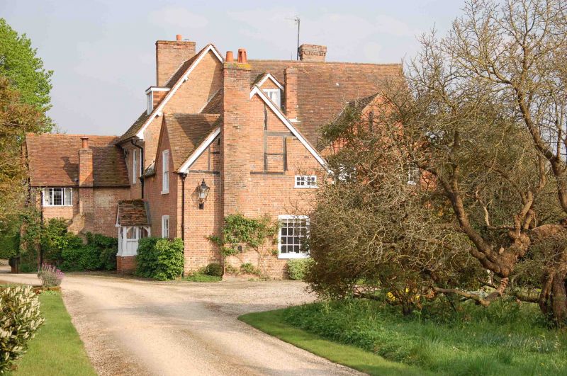
House. C17, with C18 front and C19 extensions. Red brick; plain tile roof; brick stacks. Lobby-entry plan. Garden front, former entrance front: 2 storeys and attic: 4-window range. Central C19 six-panel part-glazed door to C19 square-plan porch, with gabled tiled roof C19 French door to left. 3 unhorned sashes. 4 unhorned 12-pane sashes to first floor. 2 cross gables to roof with tile-hanging and 2-light casements. Rear: Timber frame with brick infill projecting cross gables to left. 2 bays to centre with 2 late C17 leaded cross-windows to ground and first floor. Interior: Dog-leg stairs with timber-frame with rendered infill to one side of well. Late C17 panelled room to first floor rear with bolection moulding panelling and doors with H-hinges. Subsidiary C19 two-storey wings to left and right of main front.
Listing NGR: SU6087079746
External links are from the relevant listing authority and, where applicable, Wikidata. Wikidata IDs may be related buildings as well as this specific building. If you want to add or update a link, you will need to do so by editing the Wikidata entry.


Other nearby listed buildings