Latitude: 51.7088 / 51°42'31"N
Longitude: -1.0086 / 1°0'30"W
OS Eastings: 468598
OS Northings: 201588
OS Grid: SP685015
Mapcode National: GBR B15.XGF
Mapcode Global: VHDVM.G9NV
Plus Code: 9C3WPX5R+GH
Entry Name: Church of St Giles
Listing Date: 18 July 1963
Grade: II
Source: Historic England
Source ID: 1059662
English Heritage Legacy ID: 249121
Also known as: St Giles' Church, Tetsworth
ID on this website: 101059662
Location: St Giles's Church, Tetsworth, South Oxfordshire, OX9
County: Oxfordshire
District: South Oxfordshire
Civil Parish: Tetsworth
Built-Up Area: Tetsworth
Traditional County: Oxfordshire
Lieutenancy Area (Ceremonial County): Oxfordshire
Church of England Parish: Tetsworth
Church of England Diocese: Oxford
Tagged with: Church building
TETSWORTH CHILTERN VIEW SP6801 (North side) 11/107 Church of St. Giles 18/07/63
GV II
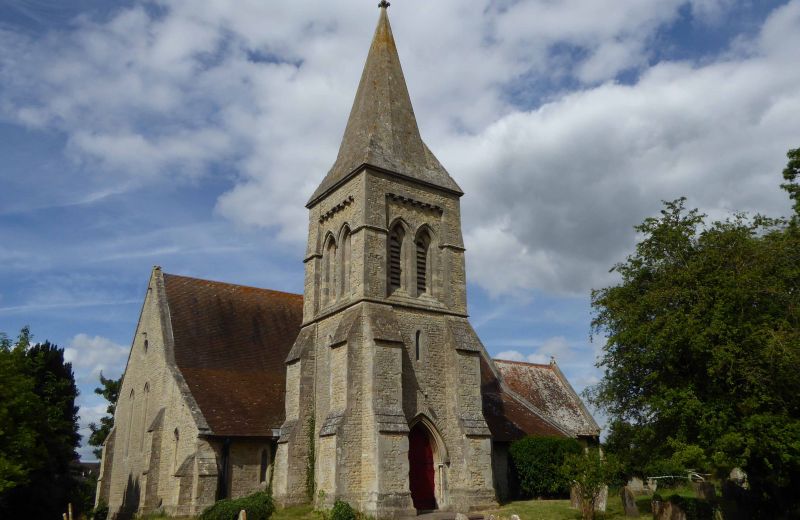
Church. c.1855, by J. Billing of Reading. Coursed squared stone; old plain-tile roof to nave, aisle, chancel and vestry; stone tower. 5-bay nave with south aisle, 2-bay chancel, tower to south, vestry to north. Early English style. 2-centre arched doorway to base of tower with double-leaf plank doors. Lancets to all openings. Tower of 3 stages with angle buttresses, paired louvred lancet openings to third stage of tower. Broach spire. 2-bay braced collar-truss roof to chancel with king-posts; 5-bay arch-braced scissor-truss roof to nave; lean-to roof to aisle. Painted commandments to reredos; 2-centred chancel arch on half-columns; wood pulpit on stone plinth. C19 stone font. (Buildings of England: Oxfordshire, 1974, p. 805; V.C.H.: Oxfordshire, Vol.VII, 1962, p. 157-8).
Listing NGR: SP6859801588
External links are from the relevant listing authority and, where applicable, Wikidata. Wikidata IDs may be related buildings as well as this specific building. If you want to add or update a link, you will need to do so by editing the Wikidata entry.


Other nearby listed buildings