Latitude: 51.7101 / 51°42'36"N
Longitude: -1.0065 / 1°0'23"W
OS Eastings: 468744
OS Northings: 201732
OS Grid: SP687017
Mapcode National: GBR B15.QCV
Mapcode Global: VHDVM.H8SV
Plus Code: 9C3WPX6V+2C
Entry Name: Emerton House
Listing Date: 18 July 1963
Last Amended: 5 August 1987
Grade: II
Source: Historic England
Source ID: 1181063
English Heritage Legacy ID: 249127
ID on this website: 101181063
Location: Tetsworth, South Oxfordshire, OX9
County: Oxfordshire
District: South Oxfordshire
Civil Parish: Tetsworth
Built-Up Area: Tetsworth
Traditional County: Oxfordshire
Lieutenancy Area (Ceremonial County): Oxfordshire
Church of England Parish: Tetsworth
Church of England Diocese: Oxford
Tagged with: House
TETSWORTH HIGH STREET SP6801 (South side) 11/113 No.64 (Emerton House) 18/07/63 (Formerly listed as Swan Villa (House 80 yards NNW of The King's Arms))
- II
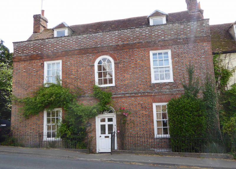
House. Probably mid C18. Red brick with flared headers in Flemish bond; old plain-tile roof; brick end stacks. 2 storeys and attic; 3-window range. 6-panel part-glazed door to centre with decorative fanlight and rubbed brick arched head. 12-pane unhorned sashes to left and right with painted wood architrave surrounds and cambered rubbed-brick heads. Flat brick band between ground and first floors. 12-pane unhorned round-head sash to first floor centre with painted wood architrave surround and rubbed-brick arched head with blocks to impost. 12-pane unhorned sashes to left and right with painted wood architrave surrounds and cambered rubbed-brick heads. Stepped brick courses to base of plain brick parapet to eaves. 2 hipped dormers. Interior not inspected.
Listing NGR: SP6874401732
External links are from the relevant listing authority and, where applicable, Wikidata. Wikidata IDs may be related buildings as well as this specific building. If you want to add or update a link, you will need to do so by editing the Wikidata entry.


Other nearby listed buildings