Latitude: 51.6499 / 51°38'59"N
Longitude: -1.0572 / 1°3'26"W
OS Eastings: 465322
OS Northings: 194992
OS Grid: SU653949
Mapcode National: GBR B1W.HJ1
Mapcode Global: VHCYB.MSFJ
Plus Code: 9C3WJWXV+X4
Entry Name: Church of St Bartholomew, Chest Tomb Approximately 1.7 Metres East of South Porch
Listing Date: 3 April 1987
Grade: II
Source: Historic England
Source ID: 1059764
English Heritage Legacy ID: 248859
ID on this website: 101059764
Location: St Bartholomew's Church, Brightwell Baldwin, South Oxfordshire, OX49
County: Oxfordshire
District: South Oxfordshire
Civil Parish: Brightwell Baldwin
Traditional County: Oxfordshire
Lieutenancy Area (Ceremonial County): Oxfordshire
Church of England Parish: Brightwell Baldwin
Church of England Diocese: Oxford
Tagged with: Chest tomb
BRIGHTWELL BALDWIN SU6594 15/14 Church of St. Bartholomew, chest tomb approx. 1.7m. E of S porch
GV II
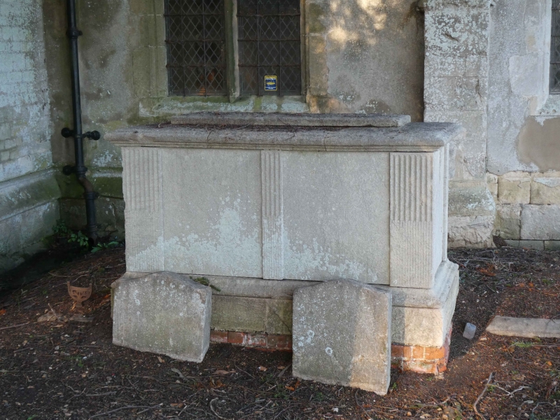
Chest tomb. c.1790. Limestone. Moulded plinth and top, reeded corner pilasters and pilaster strips.
Listing NGR: SU6532294992
External links are from the relevant listing authority and, where applicable, Wikidata. Wikidata IDs may be related buildings as well as this specific building. If you want to add or update a link, you will need to do so by editing the Wikidata entry.


Other nearby listed buildings