Latitude: 51.2175 / 51°13'3"N
Longitude: 0.532 / 0°31'55"E
OS Eastings: 576927
OS Northings: 149528
OS Grid: TQ769495
Mapcode National: GBR PRT.P9Z
Mapcode Global: VHJMM.5NMH
Plus Code: 9F326G9J+2R
Entry Name: Church Farm Barn
Listing Date: 25 March 1987
Grade: II
Source: Historic England
Source ID: 1060760
English Heritage Legacy ID: 174486
ID on this website: 101060760
Location: Maidstone, Kent, ME17
County: Kent
District: Maidstone
Civil Parish: Boughton Monchelsea
Traditional County: Kent
Lieutenancy Area (Ceremonial County): Kent
Tagged with: Building
BOUGHTON MONCHELSEA CHURCH HILL TQ 74 NE (West side)
2/26 Church Farm Barn
GV II
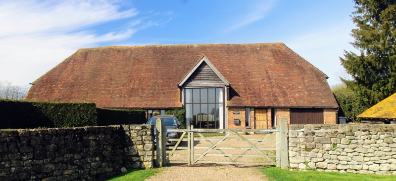
Barn, now house. C17, with C18 cladding, converted to house 1982-83. Timber framed, clad with red and grey brick. Front elevation of left end bay clad with buff brick in Flemish bond. Plain tile roof. 5 timber-framed bays, formerly with central midstrey. Further bay added to south. Front and rear aisles. 1 1/2 storeys. Half-hipped roof. Gabled porch rising from aisle to right of centre, with weatherboarded gable, and paned window in place of doors. Upper storey end lit. Irregular fenestration of 7 windows apart from porch; one 4-pane light with segmental head to left addition, one 3-light casement, and 4 vertical slit lights. Further 2-light casement within blocked doorway to left end. Ribbed door towards right end and ribbed garage doors to right end. Interior: exposed framing. Long shaped jowls. Arch-braced tie beams and arcade plates. Clasped-purlin roof with diminishing principal rafters. Vertical queen-struts to collars. Edge-halved arcade-plate scarf. High aisle tie-beams. Curved passing shores. Scribed and chiselled carpenters' marks of same period.
Listing NGR: TQ7692749528
External links are from the relevant listing authority and, where applicable, Wikidata. Wikidata IDs may be related buildings as well as this specific building. If you want to add or update a link, you will need to do so by editing the Wikidata entry.


Other nearby listed buildings