Latitude: 51.2148 / 51°12'53"N
Longitude: 0.6939 / 0°41'37"E
OS Eastings: 588241
OS Northings: 149625
OS Grid: TQ882496
Mapcode National: GBR QTC.N8R
Mapcode Global: VHJMP.ZQ6M
Plus Code: 9F326M7V+WH
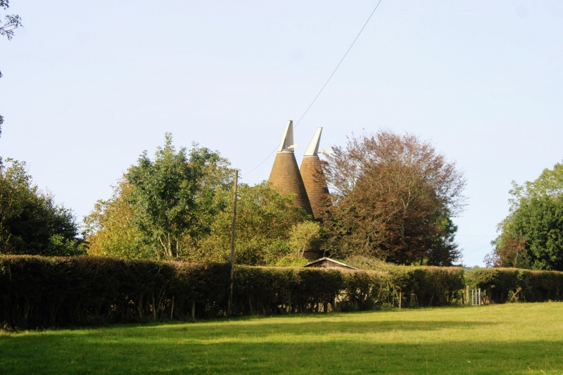
Entry Name: Former Oasthouse About 12 Metres East South East of Boughton Place
Listing Date: 21 October 1986
Grade: II
Source: Historic England
Source ID: 1060860
English Heritage Legacy ID: 174234
ID on this website: 101060860
BOUGHTON MALHERBE CHURCH ROAD TQ 84 NE [North side)
Grafty Green
6/8 Former Dasthouse about 12 metres east-south-east of Boughton Place
GV II
Possibly part of Boughton Malherbe Place, formerly oasthouse, now house. C16 or C17. Kilns added in C19. Converted to house 1985. Red and grey brick in English bond. Kilns red and grey brick in Flemish bond. Plain tile roofs. T-plan stowage; stem of T double depth. 2 circular kilns across head. 2 storeys. Dentilled brick eaves cornice to kilns. Hipped roof to each range of stowage. Conical roofs to kilns, with cowls. C20 two-and three-light wooden casements, ground floor windows with segmental heads. C20 double doors to west. Interior not inspected. Included for group value.
Listing NGR: TQ8819449629
External links are from the relevant listing authority and, where applicable, Wikidata. Wikidata IDs may be related buildings as well as this specific building. If you want to add or update a link, you will need to do so by editing the Wikidata entry.


Other nearby listed buildings