Approximate Location Map
Large Map »
Latitude: 53.0069 / 53°0'24"N
Longitude: -0.6267 / 0°37'36"W
OS Eastings: 492242
OS Northings: 346395
OS Grid: SK922463
Mapcode National: GBR DNZ.JCH
Mapcode Global: WHGK3.BPS5
Plus Code: 9C5X294F+Q8
Entry Name: Hough House
Listing Date: 14 September 1984
Grade: II
Source: Historic England
Source ID: 1062376
English Heritage Legacy ID: 193196
ID on this website: 101062376
Location: Hough-on-the-Hill, South Kesteven, Lincolnshire, NG32
County: Lincolnshire
District: South Kesteven
Civil Parish: Hough-on-the-Hill
Traditional County: Lincolnshire
Lieutenancy Area (Ceremonial County): Lincolnshire
Church of England Parish: Hough-on-the-Hill All Saints
Church of England Diocese: Lincoln
Tagged with: House
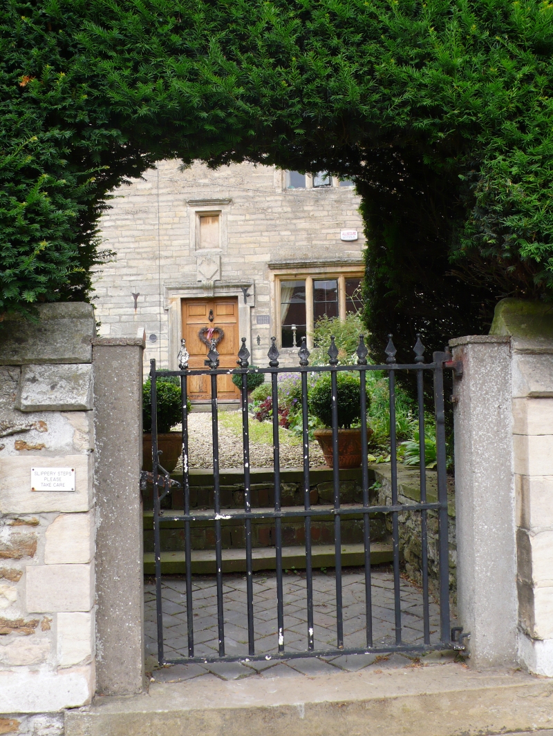
SK 94 NW HOUGH-ON-THE-HILL FRIESTON ROAD
(north side)
3/106 Hough House
G.V. II
Small country house. 1624, C18, C19, C20. Limestone ashlar, coursed
ironstone rubble with limestone dressings, pantile roofs with central
ridge stack on west range and 2 ridge stacks on south range. L-plan.
2 storey and garret. Late C17 ashlar south front of west range of 3 bays
with plinth and central doorway with lugged moulded architrave
scrolled and beaded raised keystone, 8 panelled door and small decorated
plaque, and small blocked window above. Doorway flanked by single
3 light mullion windows with moulded cornices. 2, three light mullion
windows above with moulded cornices. North side of west range rebuilt
in C19 but early C17 2 light mullion window to cellar intact. Early C18
rubble south range with C19 south front with plinth and first and second
floor stringcourses. Ground floor 4 light mullion window with transom.
First floor 4 light mullion window with 3 light mullion window in gable.
North-east wall of 1624 with contemporary blocked fireplace with shallow
moulded head. Over west range, a late C17 butt purlin roof intact, with
C19 clasped purlin roof over south range. North gable collapsed and
rebuilt in C20, datestone inscribed 1624 discovered inside but now
lost.
Source: D. L. Roberts, Vernacular Building in Kesteven.
Listing NGR: SK9224246395
External links are from the relevant listing authority and, where applicable, Wikidata. Wikidata IDs may be related buildings as well as this specific building. If you want to add or update a link, you will need to do so by editing the Wikidata entry.


Other nearby listed buildings
