Latitude: 53.0259 / 53°1'33"N
Longitude: -0.6031 / 0°36'11"W
OS Eastings: 493788
OS Northings: 348532
OS Grid: SK937485
Mapcode National: GBR DNT.BBG
Mapcode Global: WHGK3.Q60M
Plus Code: 9C5X29GW+8Q
Entry Name: 7 and 9, Church Lane
Listing Date: 14 September 1984
Grade: II
Source: Historic England
Source ID: 1062432
English Heritage Legacy ID: 193126
ID on this website: 101062432
Location: Caythorpe, South Kesteven, Lincolnshire, NG32
County: Lincolnshire
District: South Kesteven
Civil Parish: Caythorpe
Built-Up Area: Caythorpe
Traditional County: Lincolnshire
Lieutenancy Area (Ceremonial County): Lincolnshire
Church of England Parish: Caythorpe St Vincent
Church of England Diocese: Lincoln
Tagged with: Building
SK 9248-9348
8/35
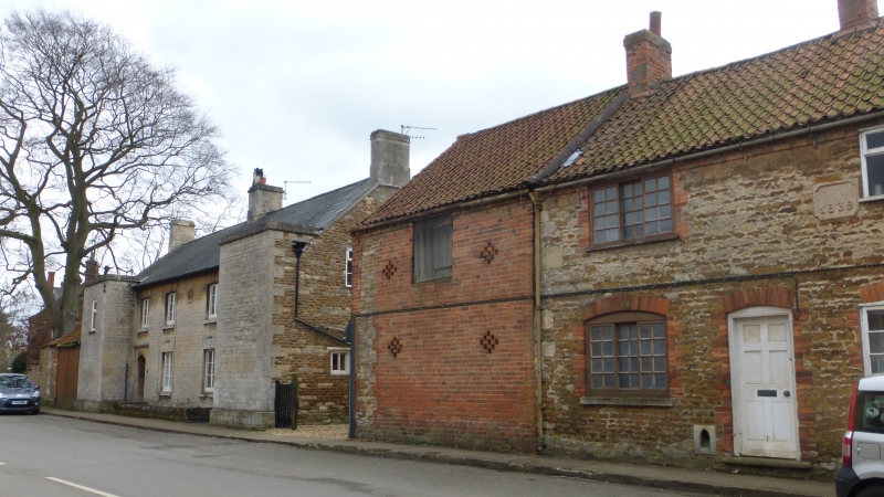
CAYTHORPE
CHURCH LANE
(south side)
Nos 7 and 9
G.V.
II
Cottages, 1836, coursed dressed limestone rubble, ashlar quoins and
dressings, slate roof with 2 gable and one ridge stacks. 6 bay front
with flanking pair advanced, 2 storeys. 2 off centre panelled glazed
doors recessed beneath sharply pointed 4 centred arches with drip mould
and label stops. Between the doors are two 2-light glazing bar casements.
On the first floor are four similar windows with, to the left, a small
single light glazing bar casement in the projecting bay. All but the
last window have flat lintels with raised keyblocks. Datestone 1836
in centre of front at first floor level.
Listing NGR: SK9378848532
External links are from the relevant listing authority and, where applicable, Wikidata. Wikidata IDs may be related buildings as well as this specific building. If you want to add or update a link, you will need to do so by editing the Wikidata entry.


Other nearby listed buildings