Latitude: 53.3657 / 53°21'56"N
Longitude: -0.0098 / 0°0'35"W
OS Eastings: 532524
OS Northings: 387275
OS Grid: TF325872
Mapcode National: GBR XYCJ.N6
Mapcode Global: WHHJS.TNJM
Plus Code: 9C5X9X8R+73
Entry Name: Westgate House
Listing Date: 2 November 1954
Grade: II*
Source: Historic England
Source ID: 1063182
English Heritage Legacy ID: 195056
ID on this website: 101063182
Location: Louth, East Lindsey, Lincolnshire, LN11
County: Lincolnshire
District: East Lindsey
Civil Parish: Louth
Built-Up Area: Louth
Traditional County: Lincolnshire
Lieutenancy Area (Ceremonial County): Lincolnshire
Church of England Parish: Louth
Church of England Diocese: Lincoln
Tagged with: House
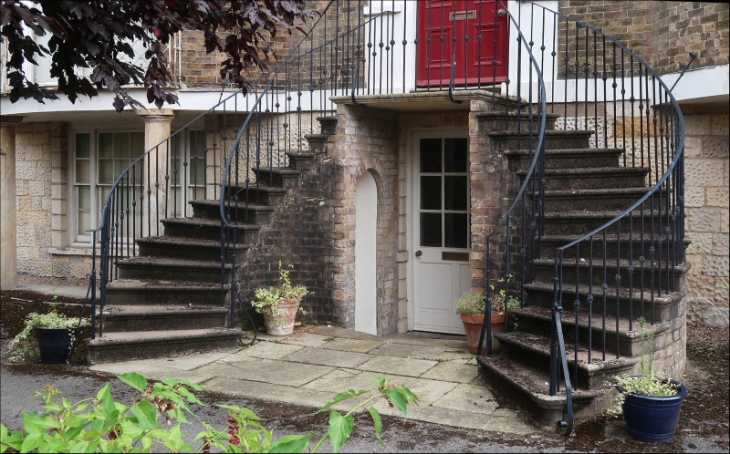
WESTGATE 1. 1348 (South Side) Westgate House TF 3287 2/8 2.ll.54. II* GV 2. Late C18, double bow-fronted 3-storey yellow brick house. 3 windows. Flattened mansard roof of Westmorland slate with 3 dormers. Basement of vermiculated rusticated stone. Ground floor has columns supporting bays and a curved double staircase with iron handrails leads to the central entrance at 1st floor level. Wide segmental fanlight above panelled door, 2 half-length side lights. 5-light windows to each floor in bays and under. Flat-arched heads to windows of 1st and 2nd floor, iron balconies to ground floor. Former stable block with gable end to Westgate of 2 storeys in brick. Steep pantile roof, C18, included as a group with Westgate House.
Nos 25, 29 to 31 (odd), Westgate House, The Limes and Nos 43 to 47 (odd) form a group.
Listing NGR: TF3252487275
External links are from the relevant listing authority and, where applicable, Wikidata. Wikidata IDs may be related buildings as well as this specific building. If you want to add or update a link, you will need to do so by editing the Wikidata entry.


Other nearby listed buildings