Approximate Location Map
Large Map »
Latitude: 53.367 / 53°22'1"N
Longitude: -0.0043 / 0°0'15"W
OS Eastings: 532886
OS Northings: 387422
OS Grid: TF328874
Mapcode National: GBR XYDH.VR
Mapcode Global: WHHJS.XM3P
Plus Code: 9C5X9X8W+Q7
Entry Name: 46, Eastgate
Listing Date: 18 February 1974
Grade: II
Source: Historic England
Source ID: 1063221
English Heritage Legacy ID: 194961
ID on this website: 101063221
Location: Louth, East Lindsey, Lincolnshire, LN11
County: Lincolnshire
District: East Lindsey
Civil Parish: Louth
Built-Up Area: Louth
Traditional County: Lincolnshire
Lieutenancy Area (Ceremonial County): Lincolnshire
Church of England Parish: Louth
Church of England Diocese: Lincoln
Tagged with: Building
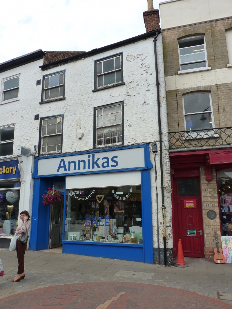
EASTGATE
1.
1348
(West Side)
No 46
TP 38 NW 1/197
II GV
2.
Early C19. 3 storeys in painted brick. Welsh slate roof with brick chimney.
2 windows, marginal glazing. Modern shop front. Listed solely as part of a
group.
Nos 46 to 50 (even) form a group.
Listing NGR: TF3288687422
External links are from the relevant listing authority and, where applicable, Wikidata. Wikidata IDs may be related buildings as well as this specific building. If you want to add or update a link, you will need to do so by editing the Wikidata entry.


Other nearby listed buildings
