Approximate Location Map
Large Map »
Latitude: 51.3577 / 51°21'27"N
Longitude: 0.0315 / 0°1'53"E
OS Eastings: 541545
OS Northings: 164028
OS Grid: TQ415640
Mapcode National: GBR MZ.6LZ
Mapcode Global: VHHP9.H4JJ
Plus Code: 9F32925J+3J
Entry Name: Keston Windmill
Listing Date: 10 January 1955
Grade: I
Source: Historic England
Source ID: 1064369
English Heritage Legacy ID: 358460
ID on this website: 101064369
Location: Keston, Bromley, London, BR2
County: London
District: Bromley
Electoral Ward/Division: Bromley Common and Keston
Parish: Non Civil Parish
Built-Up Area: Bromley
Traditional County: Kent
Lieutenancy Area (Ceremonial County): Greater London
Church of England Parish: Keston
Church of England Diocese: Rochester
Tagged with: Windmill
HEATHFIELD ROAD, KESTON
1.
4407
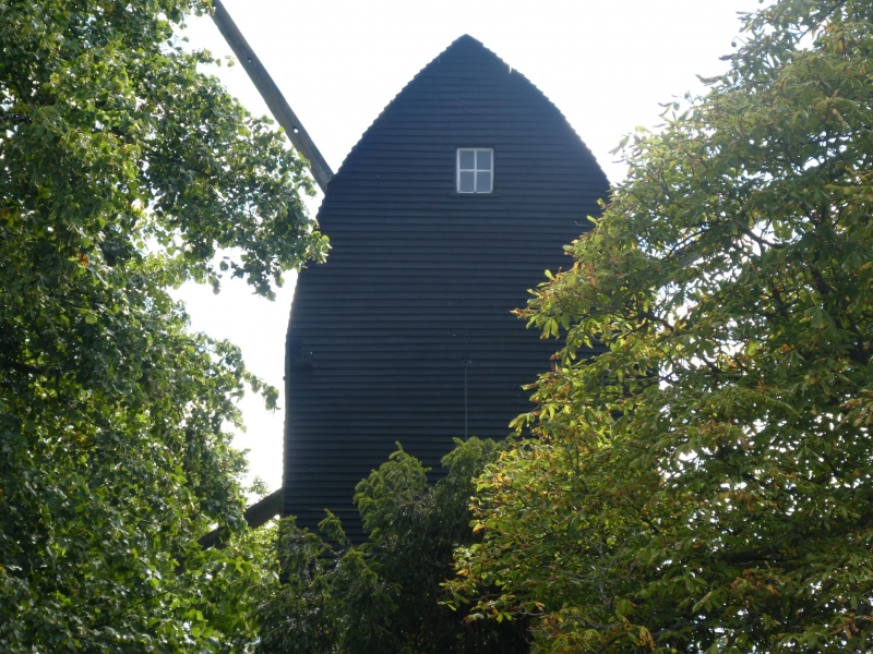
Keston Windmill
TQ 46 SW 12/59 10.1.55.
I
2.
Post type. Built in 1716. Roundhouse of tarred brick, above tarred weather-
boarding. The shutters of the sweeps and the fantail are missing. The
original machinery is in situ and in a good state of preservation.
Listing NGR: TQ4154564028
External links are from the relevant listing authority and, where applicable, Wikidata. Wikidata IDs may be related buildings as well as this specific building. If you want to add or update a link, you will need to do so by editing the Wikidata entry.


Other nearby listed buildings
