Approximate Location Map
Large Map »
Latitude: 51.3556 / 51°21'20"N
Longitude: 0.1335 / 0°8'0"E
OS Eastings: 548654
OS Northings: 163995
OS Grid: TQ486639
Mapcode National: GBR RB.8BY
Mapcode Global: VHHPC.86G4
Plus Code: 9F32944M+6C
Entry Name: Mount Hall
Listing Date: 29 June 1973
Grade: II
Source: Historic England
Source ID: 1064398
English Heritage Legacy ID: 358528
ID on this website: 101064398
Location: Chelsfield, Bromley, London, BR6
County: London
District: Bromley
Electoral Ward/Division: Chelsfield and Pratts Bottom
Parish: Non Civil Parish
Traditional County: Kent
Lieutenancy Area (Ceremonial County): Greater London
Church of England Parish: Chelsfield St Martin of Tours
Church of England Diocese: Rochester
Tagged with: Building
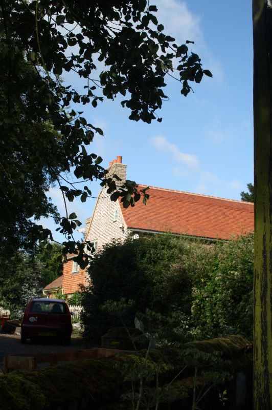
MAYPOLE ROAD, CHELSFIELD
1.
4407
Mount Hall
TQ 45 SE 10/140
II
2.
Late C18. 2 storeys with casement windows. Red brick with grey headers.
Tiled mansard roof. 2 brick chimneys either end. 3 modern casement windows.
Doorcase has cambered arch and a 6 panelled door in recess. Moulded eaves
cornice. Later left hand extensions.
Listing NGR: TQ4865463995
External links are from the relevant listing authority and, where applicable, Wikidata. Wikidata IDs may be related buildings as well as this specific building. If you want to add or update a link, you will need to do so by editing the Wikidata entry.


Other nearby listed buildings
