Approximate Location Map
Large Map »
Latitude: 51.505 / 51°30'18"N
Longitude: -0.1079 / 0°6'28"W
OS Eastings: 531415
OS Northings: 180154
OS Grid: TQ314801
Mapcode National: GBR MG.XN
Mapcode Global: VHGR0.2FTL
Plus Code: 9C3XGV4R+2R
Entry Name: St Andrew's and St John's Church of England Primary School
Listing Date: 8 February 1979
Grade: II
Source: Historic England
Source ID: 1064981
English Heritage Legacy ID: 204605
ID on this website: 101064981
Location: North Southwark, Lambeth, London, SE1
County: London
District: Lambeth
Electoral Ward/Division: Bishop's
Parish: Non Civil Parish
Built-Up Area: Lambeth
Traditional County: Surrey
Lieutenancy Area (Ceremonial County): Greater London
Church of England Parish: Waterloo St John with St Andrew
Church of England Diocese: Southwark
ROUPELL STREET SE1
1. (north side)
5023
St Andrew's and St John's
C of E Primary School
TQ 3180 1/821 8.2.79
II
2.
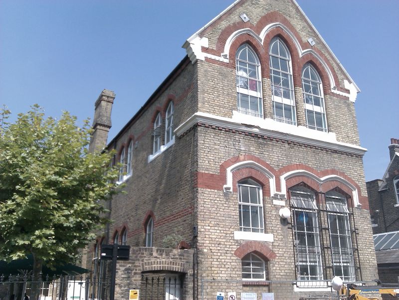
Circa 1868 by S S Teulon. U-shaped three-storey building with six-window centre,
three and five windows on inner returns. Stock brick with dressings of red brick
and stone. High pitched slated roofs. Plain inner facades relieved only by flush
red brick bands and arches to paired windows with four-centred heads and sloping
stone cills. Outer gable ends have grouped pointed windows above, four-centred
below with stone hoodmoulds dividing wide red brick extrados; stone gable kneelers
and nailhaid impost string to top windows.
Listing NGR: TQ3141580154
External links are from the relevant listing authority and, where applicable, Wikidata. Wikidata IDs may be related buildings as well as this specific building. If you want to add or update a link, you will need to do so by editing the Wikidata entry.


Other nearby listed buildings
