Latitude: 51.4662 / 51°27'58"N
Longitude: -0.1431 / 0°8'35"W
OS Eastings: 529080
OS Northings: 175770
OS Grid: TQ290757
Mapcode National: GBR DX.1L
Mapcode Global: VHGR5.GDPW
Plus Code: 9C3XFV84+FP
Entry Name: 11 and 13, Lillieshall Road SW4
Listing Date: 17 July 1978
Grade: II
Source: Historic England
Source ID: 1065040
English Heritage Legacy ID: 204453
ID on this website: 101065040
Location: Clapham, Lambeth, London, SW4
County: London
District: Lambeth
Electoral Ward/Division: Clapham Town
Parish: Non Civil Parish
Built-Up Area: Lambeth
Traditional County: Surrey
Lieutenancy Area (Ceremonial County): Greater London
Church of England Parish: Clapham Holy Trinity
Church of England Diocese: Southwark
Tagged with: Building
In the entry for:
LILLIESHALL ROAD, SW4 16/1098 (south side) Nos 11 and 13
II GV
The description shall be amended to read,
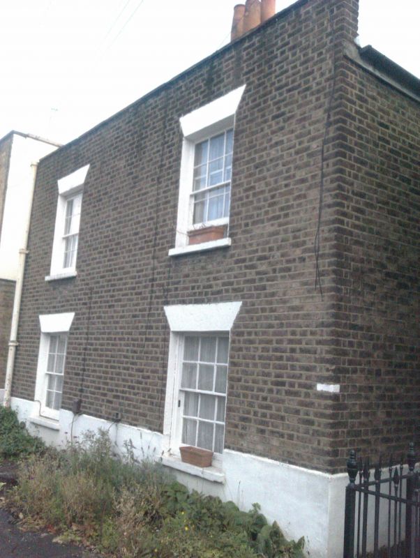
Pair of semi-detached cottages. c.1830. Stock brick; slate roof; brick ridge stack. Double-depth plan. 2 storeys; 2-window range. Flat brick arches over 12-pane sashes to right and mid C20 windows to left; semi-circular arched door- ways to each side elevation. One-storey service rooms with brick stacks to rear. Interior of No 11: panelled doors set in reeded architraves; simple classical fireplaces with cast-iron grates to first floor. Rear service room has stone flag floor and beneath party wall to No 13, a square brick-built cistern which is a rare and unusual survival; the brick stack probably served a washing copper which has now gone.
------------------------------------
LILLIESHALL ROAD SW4 1. (south side) 5023 Nos 11 and 13 TQ 2975 16/1098 17.7.78
II GV
2. Early to mid C19. Two storeys. Stock brick. Two sashes, one replaced by cast iron window. Parapet.
Listing NGR: TQ2908075770
External links are from the relevant listing authority and, where applicable, Wikidata. Wikidata IDs may be related buildings as well as this specific building. If you want to add or update a link, you will need to do so by editing the Wikidata entry.


Other nearby listed buildings