Approximate Location Map
Large Map »
Latitude: 51.4663 / 51°27'58"N
Longitude: -0.1436 / 0°8'36"W
OS Eastings: 529050
OS Northings: 175784
OS Grid: TQ290757
Mapcode National: GBR CX.YJ
Mapcode Global: VHGR5.GDGR
Plus Code: 9C3XFV84+GH
Entry Name: 20 and 22, Lillieshall Road SW4
Listing Date: 17 July 1978
Grade: II
Source: Historic England
Source ID: 1357908
English Heritage Legacy ID: 204459
ID on this website: 101357908
Location: Clapham, Lambeth, London, SW4
County: London
District: Lambeth
Electoral Ward/Division: Clapham Town
Parish: Non Civil Parish
Built-Up Area: Lambeth
Traditional County: Surrey
Lieutenancy Area (Ceremonial County): Greater London
Church of England Parish: Clapham St Paul
Church of England Diocese: Southwark
Tagged with: Building
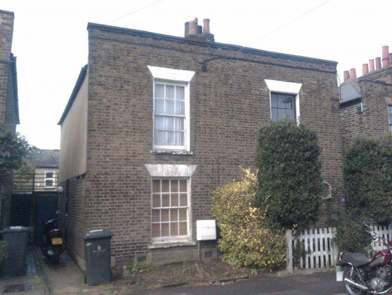
LILLIESHALL ROAD SW4
1. (north side)
5023
Nos 20 and 22
TQ 2975 16/1104 17.7.78
II GV
2.
Early to mid C19. Two storeys. Stock brick. Two sashes. Parapet.
Listing NGR: TQ2905075784
External links are from the relevant listing authority and, where applicable, Wikidata. Wikidata IDs may be related buildings as well as this specific building. If you want to add or update a link, you will need to do so by editing the Wikidata entry.


Other nearby listed buildings
